Audet, Quebec
Audet | |
|---|---|
Municipality | |
 | |
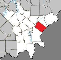 Location within Le Granit RCM | |
 Audet Location in southern Quebec | |
| Coordinates: 45°39′N 70°44′W / 45.650°N 70.733°WCoordinates: 45°39′N 70°44′W / 45.650°N 70.733°W[1] | |
| Country | |
| Province | |
| Region | Estrie |
| RCM | Le Granit |
| Constituted | November 26, 1903 |
| Government | |
| • Mayor | Jean-Marc Grondin |
| • Federal riding | Mégantic—L'Érable |
| • Prov. riding | Mégantic |
| Area | |
| • Total | 134.00 km2 (51.74 sq mi) |
| • Land | 135.86 km2 (52.46 sq mi) |
| There is an apparent contradiction between two authoritative sources | |
| Population | |
| • Total | 734 |
| • Density | 5.4/km2 (14/sq mi) |
| • Pop 2011-2016 | |
| • Dwellings | 303 |
| Time zone | UTC−5 (EST) |
| • Summer (DST) | UTC−4 (EDT) |
| Postal code(s) | G0Y 1A0 |
| Area code(s) | 819 |
| Highways | |
| Website | www |

Audet is a municipality in the Le Granit Regional County Municipality in the Estrie region of Quebec, Canada. Population is 734 as of the Canada 2016 Census.
Although the post office has been known as Audet since 1894, named after Michel Audet, the first postmaster, the municipality was known as Saint-Hubert-de-Spaulding until 1959, referring to the township of Spaulding, in which it is located.
Audet sits on a plateau at 535 metres in altitude in the Appalachians, making it one of the highest municipalities in Quebec.
Sources[]
- ^ Reference number 2552 of the Commission de toponymie du Québec (in French)
- ^ Jump up to: a b Geographic code 30055 in the official Répertoire des municipalités (in French)
- ^ Jump up to: a b "(Code 2430055) Census Profile". 2011 census. Statistics Canada. 2012.
| Wikimedia Commons has media related to Audet, Quebec. |
| show Places adjacent to Audet, Quebec |
|---|
| show |
|---|
| Authority control |
|
|---|
This Estrie location article is a stub. You can help Wikipedia by . |
Categories:
- Municipalities in Quebec
- Incorporated places in Estrie
- Le Granit Regional County Municipality
- Estrie geography stubs