Laurel Park, North Carolina
Laurel Park, North Carolina | |
|---|---|
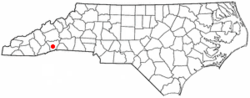 Location of Laurel Park, North Carolina | |
| Coordinates: 35°18′51″N 82°29′50″W / 35.31417°N 82.49722°WCoordinates: 35°18′51″N 82°29′50″W / 35.31417°N 82.49722°W | |
| Country | United States |
| State | North Carolina |
| County | Henderson |
| Incorporated | 1925[1] |
| Area | |
| • Total | 2.82 sq mi (7.31 km2) |
| • Land | 2.80 sq mi (7.25 km2) |
| • Water | 0.02 sq mi (0.06 km2) |
| Elevation | 2,385 ft (727 m) |
| Population (2010) | |
| • Total | 2,180 |
| • Estimate (2019)[3] | 2,330 |
| • Density | 831.85/sq mi (321.18/km2) |
| Time zone | UTC-5 (Eastern (EST)) |
| • Summer (DST) | UTC-4 (EDT) |
| ZIP code | 28739 |
| Area code(s) | 828 |
| FIPS code | 37-37160[4] |
| GNIS feature ID | 1021114[5] |
| Website | www |

Laurel Park is a town in Henderson County, North Carolina, United States. The population was 2,180 at the 2010 census.[6] It is part of the Asheville Metropolitan Statistical Area.
History[]
The Singletary-Reese-Robinson House was listed on the National Register of Historic Places in 2010.[7]
Geography[]
Laurel Park is located in central Henderson County at 35°18′51″N 82°29′50″W / 35.31417°N 82.49722°W (35.314074, -82.497219),[8] on the eastern slopes of Jumpoff Mountain. It is bordered to the east by the city of Hendersonville, the county seat. To the south is the unincorporated community of Valley Hill, and to the west is the community of Horse Shoe.
U.S. Route 64 passes through the northern part of the town, in the valley of Shaw Creek. Route 64 leads east into Hendersonville and west 7 miles (11 km) to Etowah.
According to the United States Census Bureau, the town has a total area of 2.8 square miles (7.3 km2), of which 0.023 square miles (0.06 km2), or 0.78%, are water.[6]
Demographics[]
| Historical population | |||
|---|---|---|---|
| Census | Pop. | %± | |
| 1930 | 127 | — | |
| 1940 | 171 | 34.6% | |
| 1950 | 302 | 76.6% | |
| 1960 | 421 | 39.4% | |
| 1970 | 581 | 38.0% | |
| 1980 | 764 | 31.5% | |
| 1990 | 1,322 | 73.0% | |
| 2000 | 1,835 | 38.8% | |
| 2010 | 2,180 | 18.8% | |
| 2019 (est.) | 2,330 | [3] | 6.9% |
| U.S. Decennial Census[9] | |||
2020 census[]
| Race | Number | Percentage |
|---|---|---|
| White (non-Hispanic) | 2,112 | 93.87% |
| Black or African American (non-Hispanic) | 15 | 0.67% |
| Native American | 1 | 0.04% |
| Asian | 13 | 0.58% |
| Pacific Islander | 3 | 0.13% |
| Other/Mixed | 54 | 2.4% |
| Hispanic or Latino | 52 | 2.31% |
As of the 2020 United States census, there were 2,250 people, 1,153 households, and 768 families residing in the town.
2000 census[]
As of the census[4] of 2000, there were 1,835 people, 930 households, and 606 families residing in the town. The population density was 683.8 people per square mile (264.4/km2). There were 1,115 housing units at an average density of 415.5 per square mile (160.6/km2). The racial makeup of the town was 98.47% White, 0.49% African American, 0.05% Native American, 0.27% Asian, 0.05% from other races, and 0.65% from two or more races. Hispanic or Latino of any race were 0.54% of the population.
There were 930 households, out of which 13.5% had children under the age of 18 living with them, 60.2% were married couples living together, 4.4% had a female householder with no husband present, and 34.8% were non-families. 31.5% of all households were made up of individuals, and 18.5% had someone living alone who was 65 years of age or older. The average household size was 1.97 and the average family size was 2.42.
In the town, the population was spread out, with 12.7% under the age of 18, 2.6% from 18 to 24, 16.5% from 25 to 44, 28.2% from 45 to 64, and 40.1% who were 65 years of age or older. The median age was 59 years. For every 100 females, there were 81.1 males. For every 100 females age 18 and over, there were 78.8 males.
The median income for a household in the town was $52,813, and the median income for a family was $59,118. Males had a median income of $49,853 versus $29,750 for females. The per capita income for the town was $35,749. About 2.2% of families and 3.3% of the population were below the poverty line, including 5.8% of those under age 18 and 2.8% of those age 65 or over.
References[]
- ^ "North Carolina Gazetteer". Retrieved December 25, 2020.
- ^ "2019 U.S. Gazetteer Files". United States Census Bureau. Retrieved July 27, 2020.
- ^ a b "Population and Housing Unit Estimates". United States Census Bureau. May 24, 2020. Retrieved May 27, 2020.
- ^ a b "U.S. Census website". United States Census Bureau. Retrieved 2008-01-31.
- ^ "US Board on Geographic Names". United States Geological Survey. 2007-10-25. Retrieved 2008-01-31.
- ^ a b "Geographic Identifiers: 2010 Census Summary File 1 (G001): Laurel Park town, North Carolina". American Factfinder. U.S. Census Bureau. Archived from the original on February 13, 2020. Retrieved December 18, 2017.
- ^ "National Register of Historic Places Listings". Weekly List of Actions Taken on Properties: 9/13/10 through 9/17/10. National Park Service. 2010-09-24.
- ^ "US Gazetteer files: 2010, 2000, and 1990". United States Census Bureau. 2011-02-12. Retrieved 2011-04-23.
- ^ "Census of Population and Housing". Census.gov. Retrieved June 4, 2015.
- ^ "Explore Census Data". data.census.gov. Retrieved 2021-12-19.
External links[]
Municipalities and communities of Henderson County, North Carolina, United States | ||
|---|---|---|
| Cities |  | |
| Towns | ||
| Village | ||
| CDPs | ||
| Unincorporated communities | ||
| Footnotes | ‡This populated place also has portions in an adjacent county or counties | |
| ||
- Towns in Henderson County, North Carolina
- Towns in North Carolina
- Asheville metropolitan area