Laurel Township, Hocking County, Ohio
Laurel Township, Hocking County, Ohio | |
|---|---|
 Rock House at Hocking Hills State Park | |
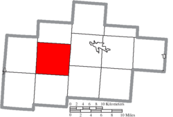 Location of Laurel Township in Hocking County | |
| Coordinates: 39°30′44″N 82°35′9″W / 39.51222°N 82.58583°WCoordinates: 39°30′44″N 82°35′9″W / 39.51222°N 82.58583°W | |
| Country | United States |
| State | Ohio |
| County | Hocking |
| Area | |
| • Total | 38.3 sq mi (99.3 km2) |
| • Land | 38.3 sq mi (99.2 km2) |
| • Water | 0.04 sq mi (0.1 km2) |
| Elevation | 1,119 ft (341 m) |
| Population (2010) | |
| • Total | 1,166 |
| • Density | 31/sq mi (11.8/km2) |
| Time zone | UTC-5 (Eastern (EST)) |
| • Summer (DST) | UTC-4 (EDT) |
| FIPS code | 39-42056[2] |
| GNIS feature ID | 1086320[1] |

Laurel Township is one of the eleven townships of Hocking County, Ohio, United States. As of the 2010 census the population was 1,166.[3]
Geography[]
Located in the western part of the county, it borders the following townships:
- Good Hope Township - north
- Falls Township (southwestern portion) - northeast
- Washington Township - southeast
- Benton Township - south
- Salt Creek Township - southwest
- Perry Township - west
No municipalities are located in Laurel Township.
Name and history[]
Laurel Township was named from the mountain-laurel native to the area.[4]
It is the only Laurel Township statewide.[5]
Government[]
The township is governed by a three-member board of trustees, who are elected in November of odd-numbered years to a four-year term beginning on the following January 1. Two are elected in the year after the presidential election and one is elected in the year before it. There is also an elected township fiscal officer,[6] who serves a four-year term beginning on April 1 of the year after the election, which is held in November of the year before the presidential election. Vacancies in the fiscal officership or on the board of trustees are filled by the remaining trustees.
References[]
- ^ a b "US Board on Geographic Names". United States Geological Survey. 2007-10-25. Retrieved 2008-01-31.
- ^ "U.S. Census website". United States Census Bureau. Retrieved 2008-01-31.
- ^ "Geographic Identifiers: 2010 Census Summary File 1 (G001): Laurel township, Hocking County, Ohio". American Factfinder. U.S. Census Bureau. Archived from the original on February 13, 2020. Retrieved January 4, 2018.
- ^ Maniskas, Judith S. (2011). Logan and Hocking County. Arcadia Publishing. p. 25. ISBN 9780738582894.
- ^ "Detailed map of Ohio" (PDF). United States Census Bureau. 2000. Retrieved 2007-02-16.
- ^ §503.24, §505.01, and §507.01 of the Ohio Revised Code. Accessed 4/30/2009.
External links[]
Municipalities and communities of Hocking County, Ohio, United States | ||
|---|---|---|
| City |  | |
| Villages | ||
| Townships | ||
| CDPs | ||
| Unincorporated communities | ||
| Footnotes | ‡This populated place also has portions in an adjacent county or counties | |
| ||
- Townships in Hocking County, Ohio
- Townships in Ohio