Le Mesnil-Amand
Le Mesnil-Amand | |
|---|---|
Part of Gavray-sur-Sienne | |
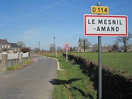 Entrance of the village | |
show Location of Le Mesnil-Amand | |
 Le Mesnil-Amand | |
| Coordinates: 48°52′56″N 1°21′42″W / 48.8822°N 1.3617°WCoordinates: 48°52′56″N 1°21′42″W / 48.8822°N 1.3617°W | |
| Country | France |
| Region | Normandy |
| Department | Manche |
| Arrondissement | Coutances |
| Canton | Quettreville-sur-Sienne |
| Commune | Gavray-sur-Sienne |
| Area 1 | 6.78 km2 (2.62 sq mi) |
| Population (2017)[1] | 166 |
| • Density | 24/km2 (63/sq mi) |
| Time zone | UTC+01:00 (CET) |
| • Summer (DST) | UTC+02:00 (CEST) |
| Postal code | 50450 |
| Elevation | 30–131 m (98–430 ft) |
| 1 French Land Register data, which excludes lakes, ponds, glaciers > 1 km2 (0.386 sq mi or 247 acres) and river estuaries. | |


Le Mesnil-Amand (French pronunciation: [lə menil amɑ̃]) is a former commune in the Manche department in Normandy in north-western France. On 1 January 2019, it was merged into the new commune Gavray-sur-Sienne.[2]
See also[]
- Communes of the Manche department
References[]
- ^ Téléchargement du fichier d'ensemble des populations légales en 2017, INSEE
- ^ Arrêté préfectoral 12 December 2018 (in French)
| Wikimedia Commons has media related to Le Mesnil-Amand. |
This Manche geographical article is a stub. You can help Wikipedia by . |
Categories:
- Former communes of Manche
- Manche geography stubs