Gavray-sur-Sienne
Gavray-sur-Sienne | |
|---|---|
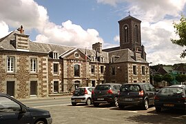 The town hall in the center of Gavray | |
Location of Gavray-sur-Sienne  | |
 Gavray-sur-Sienne | |
| Coordinates: 48°54′38″N 1°20′56″W / 48.9106°N 1.3489°WCoordinates: 48°54′38″N 1°20′56″W / 48.9106°N 1.3489°W | |
| Country | France |
| Region | Normandy |
| Department | Manche |
| Arrondissement | Coutances |
| Canton | Quettreville-sur-Sienne |
| Intercommunality | Coutances Mer et Bocage |
| Area 1 | 38.02 km2 (14.68 sq mi) |
| Population (Jan. 2018)[1] | 1,963 |
| • Density | 52/km2 (130/sq mi) |
| Time zone | UTC+01:00 (CET) |
| • Summer (DST) | UTC+02:00 (CEST) |
| INSEE/Postal code | 50197 /50450 |
| Elevation | 24–186 m (79–610 ft) |
| Website | www.gavray.fr |
| 1 French Land Register data, which excludes lakes, ponds, glaciers > 1 km2 (0.386 sq mi or 247 acres) and river estuaries. | |


Gavray-sur-Sienne (French pronunciation: [ɡavʁɛ syʁ sjɛn]) is a commune in the Manche department in north-western France. It was established on 1 January 2019 by merger of the former communes of Gavray (the seat), Le Mesnil-Amand, Le Mesnil-Rogues and Sourdeval-les-Bois.[2]
See also[]
- Communes of the Manche department
References[]
- ^ "Populations légales 2018". The National Institute of Statistics and Economic Studies. 28 December 2020.
- ^ Arrêté préfectoral 12 December 2018 (in French)
| Wikimedia Commons has media related to Gavray-sur-Sienne. |
Communes of Manche | |
|---|---|
|
This Manche geographical article is a stub. You can help Wikipedia by . |
Categories:
- Communes of Manche
- Manche geography stubs