Tessy-Bocage
Tessy-Bocage | |
|---|---|
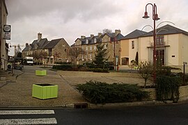 The market square in Tessy-sur-Vire | |
Location of Tessy-Bocage  | |
 Tessy-Bocage | |
| Coordinates: 48°58′23″N 1°03′36″W / 48.973°N 1.060°WCoordinates: 48°58′23″N 1°03′36″W / 48.973°N 1.060°W | |
| Country | France |
| Region | Normandy |
| Department | Manche |
| Arrondissement | Saint-Lô |
| Canton | Condé-sur-Vire |
| Intercommunality | Saint-Lô Agglo |
| Government | |
| • Mayor (2020–2026) | Michel Richard |
| Area 1 | 34.24 km2 (13.22 sq mi) |
| Population (Jan. 2018)[1] | 2,317 |
| • Density | 68/km2 (180/sq mi) |
| Time zone | UTC+01:00 (CET) |
| • Summer (DST) | UTC+02:00 (CEST) |
| INSEE/Postal code | 50592 /50420 |
| 1 French Land Register data, which excludes lakes, ponds, glaciers > 1 km2 (0.386 sq mi or 247 acres) and river estuaries. | |


Tessy-Bocage (French pronunciation: [tɛsi bɔkaʒ]) is a commune in the department of Manche, northwestern France. The municipality was established on 1 January 2016 by merger of the former communes of Fervaches and Tessy-sur-Vire (the seat).[2] On 1 January 2018, the former commune of Pont-Farcy (part of the department of Calvados before 2018) was merged into it.[3]
See also[]
- Communes of the Manche department
References[]
| Wikimedia Commons has media related to Tessy-Bocage. |
- ^ "Populations légales 2018". The National Institute of Statistics and Economic Studies. 28 December 2020.
- ^ Arrêté préfectoral 28 September 2015 (in French)
- ^ Arrêté préfectoral 28 December 2017 (in French)
Communes of Manche | |
|---|---|
|
This Manche geographical article is a stub. You can help Wikipedia by . |
Categories:
- Communes of Manche
- Populated places established in 2016
- 2016 establishments in France
- Manche geography stubs