Arrondissement of Saint-Lô
Saint-Lô | |
|---|---|
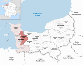 Location within the region Normandy | |
| Country | France |
| Region | Normandy |
| Department | Manche |
| No. of communes | 87 |
| Prefecture | Saint-Lô |
| Area | 1,277.3 km2 (493.2 sq mi) |
| Population (Jan. 2018)[1] | 102,928 |
| • Density | 81/km2 (210/sq mi) |
| INSEE code | 504 |
The arrondissement of Saint-Lô is an arrondissement of France in the Manche department in the Normandy region. It has 87 communes.[2] Its population is 103,045 (2016), and its area is 1,277.3 km2 (493.2 sq mi).[3]
Composition[]
The communes of the arrondissement of Saint-Lô, and their INSEE codes, are:[2]
- Agneaux (50002)
- Airel (50004)
- Amigny (50006)
- Auvers (50023)
- La Barre-de-Semilly (50032)
- Baudre (50034)
- Beaucoudray (50039)
- Bérigny (50046)
- Beslon (50048)
- Beuvrigny (50050)
- Biéville (50054)
- La Bloutière (50060)
- Bourguenolles (50069)
- Bourgvallées (50546)
- Canisy (50095)
- Carantilly (50098)
- Carentan-les-Marais (50099)
- Cavigny (50106)
- Cerisy-la-Forêt (50110)
- Champrepus (50118)
- Chérencé-le-Héron (50130)
- La Colombe (50137)
- Condé-sur-Vire (50139)
- Couvains (50148)
- Dangy (50159)
- Le Dézert (50161)
- Domjean (50164)
- Fleury (50185)
- Fourneaux (50192)
- Gouvets (50214)
- Graignes-Mesnil-Angot (50216)
- Le Guislain (50225)
- La Haye-Bellefond (50234)
- Lamberville (50261)
- La Lande-d'Airou (50262)
- Le Lorey (50279)
- La Luzerne (50283)
- Margueray (50291)
- Marigny-le-Lozon (50292)
- Maupertuis (50295)
- La Meauffe (50297)
- Méautis (50298)
- Le Mesnil-Amey (50302)
- Le Mesnil-Eury (50310)
- Le Mesnil-Rouxelin (50321)
- Le Mesnil-Véneron (50324)
- Montabot (50334)
- Montbray (50338)
- Montrabot (50351)
- Montreuil-sur-Lozon (50352)
- Moon-sur-Elle (50356)
- Morigny (50357)
- Moyon-Villages (50363)
- Percy-en-Normandie (50393)
- Le Perron (50398)
- Pont-Hébert (50409)
- Quibou (50420)
- Rampan (50423)
- Remilly-les-Marais (50431)
- Saint-Amand-Villages (50444)
- Saint-André-de-Bohon (50445)
- Saint-André-de-l'Épine (50446)
- Saint-Clair-sur-l'Elle (50455)
- Sainte-Cécile (50453)
- Sainte-Suzanne-sur-Vire (50556)
- Saint-Fromond (50468)
- Saint-Georges-d'Elle (50473)
- Saint-Georges-Montcocq (50475)
- Saint-Germain-d'Elle (50476)
- Saint-Gilles (50483)
- Saint-Jean-de-Daye (50488)
- Saint-Jean-d'Elle (50492)
- Saint-Jean-de-Savigny (50491)
- Saint-Lô (50502)
- Saint-Louet-sur-Vire (50504)
- Saint-Martin-de-Bonfossé (50512)
- Saint-Pierre-de-Semilly (50538)
- Saint-Vigor-des-Monts (50563)
- Terre-et-Marais (50564)
- Tessy-Bocage (50592)
- Thèreval (50239)
- Torigny-les-Villes (50601)
- Tribehou (50606)
- La Trinité (50607)
- Villebaudon (50637)
- Villedieu-les-Poêles-Rouffigny (50639)
- Villiers-Fossard (50641)
History[]
The arrondissement of Saint-Lô was created in 1800.[4] At the January 2017 reorganisation of the arrondissements of Manche, it gained one commune from the arrondissement of Coutances, and it lost two communes to the arrondissement of Coutances.[5]
As a result of the reorganisation of the cantons of France which came into effect in 2015, the borders of the cantons are no longer related to the borders of the arrondissements. The cantons of the arrondissement of Saint-Lô were, as of January 2015:[6]
- Canisy
- Carentan
- Marigny
- Percy
- Saint-Clair-sur-l'Elle
- Saint-Jean-de-Daye
- Saint-Lô-Est
- Saint-Lô-Ouest
- Tessy-sur-Vire
- Torigni-sur-Vire
- Villedieu-les-Poêles
References[]
- ^ "Téléchargement du fichier d'ensemble des populations légales en 2018". The National Institute of Statistics and Economic Studies. 28 December 2020.
- ^ a b "Arrondissement de Saint-Lô (504)". INSEE. Retrieved 2019-10-01.
- ^ "Comparateur de territoire, géographie au 01/01/2019". INSEE. Retrieved 2019-10-01.
- ^ Historique de la Manche
- ^ "Arrêté préfectoral, 20 December 2016" (PDF). pp. 27–40. Retrieved 2019-10-22.
- ^ "Populations légales 2012" (PDF). INSEE. December 2014. Retrieved 2019-10-22.

- Arrondissements of Manche