Moon-sur-Elle
Moon-sur-Elle | |
|---|---|
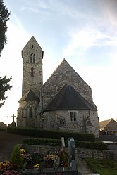 The church of Notre-Dame | |
show Location of Moon-sur-Elle | |
 Moon-sur-Elle | |
| Coordinates: 49°12′33″N 1°02′36″W / 49.2092°N 1.0433°WCoordinates: 49°12′33″N 1°02′36″W / 49.2092°N 1.0433°W | |
| Country | France |
| Region | Normandy |
| Department | Manche |
| Arrondissement | Saint-Lô |
| Canton | Pont-Hébert |
| Intercommunality | Saint-Lô Agglo |
| Government | |
| • Mayor (2020–2026) | Lydie Brotin |
| Area 1 | 9.84 km2 (3.80 sq mi) |
| Population (Jan. 2018)[1] | 823 |
| • Density | 84/km2 (220/sq mi) |
| Time zone | UTC+01:00 (CET) |
| • Summer (DST) | UTC+02:00 (CEST) |
| INSEE/Postal code | 50356 /50680 |
| Elevation | 3–48 m (9.8–157.5 ft) (avg. 30 m or 98 ft) |
| 1 French Land Register data, which excludes lakes, ponds, glaciers > 1 km2 (0.386 sq mi or 247 acres) and river estuaries. | |


Moon-sur-Elle (French pronunciation: [mɔ̃ syʁ‿ɛl], literally Moon on Elle) is a commune in the Manche department in Normandy in north-western France.
See also[]
- Communes of the Manche department
References[]
- ^ "Populations légales 2018". INSEE. 28 December 2020.
| Wikimedia Commons has media related to Moon-sur-Elle. |
| show Communes of Manche |
|---|
This Manche geographical article is a stub. You can help Wikipedia by . |
Categories:
- Communes of Manche
- Manche geography stubs