La Haye-d'Ectot
La Haye-d'Ectot | |
|---|---|
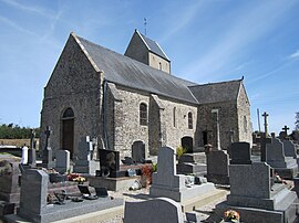 The church of Notre-Dame | |
show Location of La Haye-d'Ectot | |
 La Haye-d'Ectot | |
| Coordinates: 49°23′34″N 1°43′50″W / 49.3928°N 1.7306°WCoordinates: 49°23′34″N 1°43′50″W / 49.3928°N 1.7306°W | |
| Country | France |
| Region | Normandy |
| Department | Manche |
| Arrondissement | Cherbourg |
| Canton | Les Pieux |
| Intercommunality | CA Cotentin |
| Government | |
| • Mayor (2020–2026) | Gilbert Giot |
| Area 1 | 7.32 km2 (2.83 sq mi) |
| Population (Jan. 2018)[1] | 266 |
| • Density | 36/km2 (94/sq mi) |
| Time zone | UTC+01:00 (CET) |
| • Summer (DST) | UTC+02:00 (CEST) |
| INSEE/Postal code | 50235 /50270 |
| Elevation | 12–125 m (39–410 ft) (avg. 70 m or 230 ft) |
| 1 French Land Register data, which excludes lakes, ponds, glaciers > 1 km2 (0.386 sq mi or 247 acres) and river estuaries. | |


La Haye-d'Ectot (French pronunciation: [la ɛ dɛkto]) is a commune in the Manche department in Normandy in north-western France.
See also[]
- Communes of the Manche department
References[]
- ^ "Populations légales 2018". INSEE. 28 December 2020.
| Wikimedia Commons has media related to La Haye-d'Ectot. |
| show Communes of Manche |
|---|
This Manche geographical article is a stub. You can help Wikipedia by . |
Categories:
- Communes of Manche
- Manche geography stubs