Le Mesnil-Aubert
Le Mesnil-Aubert | |
|---|---|
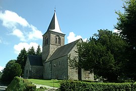 The church of Saint-Pierre | |
show Location of Le Mesnil-Aubert | |
 Le Mesnil-Aubert | |
| Coordinates: 48°56′49″N 1°24′44″W / 48.9469°N 1.4122°WCoordinates: 48°56′49″N 1°24′44″W / 48.9469°N 1.4122°W | |
| Country | France |
| Region | Normandy |
| Department | Manche |
| Arrondissement | Avranches |
| Canton | Bréhal |
| Intercommunality | Granville, Terre et Mer |
| Government | |
| • Mayor (2020–2026) | Catherine Simon |
| Area 1 | 5.96 km2 (2.30 sq mi) |
| Population (Jan. 2018)[1] | 192 |
| • Density | 32/km2 (83/sq mi) |
| Time zone | UTC+01:00 (CET) |
| • Summer (DST) | UTC+02:00 (CEST) |
| INSEE/Postal code | 50304 /50510 |
| Elevation | 14–117 m (46–384 ft) (avg. 20 m or 66 ft) |
| 1 French Land Register data, which excludes lakes, ponds, glaciers > 1 km2 (0.386 sq mi or 247 acres) and river estuaries. | |


Le Mesnil-Aubert (French pronunciation: [lə menil obɛʁ]) is a commune in the Manche department in Normandy in north-western France.
See also[]
- Communes of the Manche department
References[]
- ^ "Populations légales 2018". INSEE. 28 December 2020.
| Wikimedia Commons has media related to Le Mesnil-Aubert. |
| show Communes of Manche |
|---|
This Manche geographical article is a stub. You can help Wikipedia by . |
Categories:
- Communes of Manche
- Manche geography stubs