Crasville, Manche
Crasville | |
|---|---|
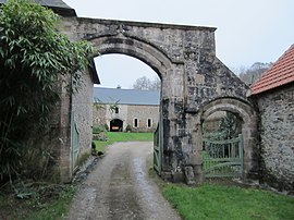 Grenneville Pavilion | |
show Location of Crasville | |
 Crasville | |
| Coordinates: 49°33′10″N 1°20′17″W / 49.5528°N 1.3381°WCoordinates: 49°33′10″N 1°20′17″W / 49.5528°N 1.3381°W | |
| Country | France |
| Region | Normandy |
| Department | Manche |
| Arrondissement | Cherbourg |
| Canton | Val-de-Saire |
| Intercommunality | CA Cotentin |
| Government | |
| • Mayor (2020–2026) | Bruno Lepley |
| Area 1 | 7.18 km2 (2.77 sq mi) |
| Population (Jan. 2018)[1] | 230 |
| • Density | 32/km2 (83/sq mi) |
| Time zone | UTC+01:00 (CET) |
| • Summer (DST) | UTC+02:00 (CEST) |
| INSEE/Postal code | 50150 /50630 |
| Elevation | 2–87 m (6.6–285.4 ft) (avg. 49 m or 161 ft) |
| 1 French Land Register data, which excludes lakes, ponds, glaciers > 1 km2 (0.386 sq mi or 247 acres) and river estuaries. | |


Crasville (French pronunciation: [kʁavil]) is a commune in the Manche department in Normandy in north-western France.[2]
See also[]
- Communes of the Manche department
References[]
- ^ "Populations légales 2018". INSEE. 28 December 2020.
- ^ Commune de Crasville (50150), INSEE
| Wikimedia Commons has media related to Crasville (Manche). |
| show Communes of Manche |
|---|
This Manche geographical article is a stub. You can help Wikipedia by . |
Categories:
- Communes of Manche
- Manche geography stubs