Le Mesnil-Adelée
Le Mesnil-Adelée | |
|---|---|
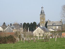 The church and surroundings in Le Mesnil-Adelée | |
show Location of Le Mesnil-Adelée | |
 Le Mesnil-Adelée | |
| Coordinates: 48°42′04″N 1°04′29″W / 48.7011°N 1.0747°WCoordinates: 48°42′04″N 1°04′29″W / 48.7011°N 1.0747°W | |
| Country | France |
| Region | Normandy |
| Department | Manche |
| Arrondissement | Avranches |
| Canton | Isigny-le-Buat |
| Intercommunality | CA Mont-Saint-Michel-Normandie |
| Government | |
| • Mayor (2020–2026) | Jean-Luc Rault |
| Area 1 | 6.82 km2 (2.63 sq mi) |
| Population (Jan. 2018)[1] | 166 |
| • Density | 24/km2 (63/sq mi) |
| Time zone | UTC+01:00 (CET) |
| • Summer (DST) | UTC+02:00 (CEST) |
| INSEE/Postal code | 50300 /50520 |
| Elevation | 47–231 m (154–758 ft) (avg. 96 m or 315 ft) |
| 1 French Land Register data, which excludes lakes, ponds, glaciers > 1 km2 (0.386 sq mi or 247 acres) and river estuaries. | |


Le Mesnil-Adelée (French pronunciation: [lə mɛnil adle]) is a commune in the Manche department in Normandy in north-western France.
See also[]
- Communes of the Manche department
References[]
- ^ "Populations légales 2018". INSEE. 28 December 2020.
| Wikimedia Commons has media related to Le Mesnil-Adelée. |
| show Communes of Manche |
|---|
This Manche geographical article is a stub. You can help Wikipedia by . |
Categories:
- Communes of Manche
- Manche geography stubs