Saint-Ovin
Saint-Ovin | |
|---|---|
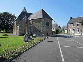 View of the village and Saint Ouen church | |
show Location of Saint-Ovin | |
 Saint-Ovin | |
| Coordinates: 48°40′56″N 1°15′37″W / 48.6822°N 1.2603°WCoordinates: 48°40′56″N 1°15′37″W / 48.6822°N 1.2603°W | |
| Country | France |
| Region | Normandy |
| Department | Manche |
| Arrondissement | Avranches |
| Canton | Pontorson |
| Intercommunality | CA Mont-Saint-Michel-Normandie |
| Government | |
| • Mayor (2020–2026) | Christian Poulain |
| Area 1 | 12.93 km2 (4.99 sq mi) |
| Population (Jan. 2018)[1] | 768 |
| • Density | 59/km2 (150/sq mi) |
| Time zone | UTC+01:00 (CET) |
| • Summer (DST) | UTC+02:00 (CEST) |
| INSEE/Postal code | 50531 /50300 |
| Elevation | 36–193 m (118–633 ft) (avg. 135 m or 443 ft) |
| 1 French Land Register data, which excludes lakes, ponds, glaciers > 1 km2 (0.386 sq mi or 247 acres) and river estuaries. | |


Saint-Ovin is a commune in the Manche department in Normandy in north-western France.
See also[]
- Communes of the Manche department
References[]
- ^ "Populations légales 2018". INSEE. 28 December 2020.
| Wikimedia Commons has media related to Saint-Ovin. |
| show Communes of Manche |
|---|
This Manche geographical article is a stub. You can help Wikipedia by . |
Categories:
- Communes of Manche
- Manche geography stubs