Pont-Hébert
Pont-Hébert | |
|---|---|
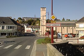 Pont-Hébert viewed from the bridge over the Vire | |
Location of Pont-Hébert  | |
 Pont-Hébert | |
| Coordinates: 49°10′04″N 1°07′55″W / 49.1678°N 1.1319°WCoordinates: 49°10′04″N 1°07′55″W / 49.1678°N 1.1319°W | |
| Country | France |
| Region | Normandy |
| Department | Manche |
| Arrondissement | Saint-Lô |
| Canton | Pont-Hébert |
| Intercommunality | CA Saint-Lô Agglo |
| Government | |
| • Mayor (2020–2026) | Michel Richomme |
| Area 1 | 29.84 km2 (11.52 sq mi) |
| Population (Jan. 2018)[1] | 1,932 |
| • Density | 65/km2 (170/sq mi) |
| Time zone | UTC+01:00 (CET) |
| • Summer (DST) | UTC+02:00 (CEST) |
| INSEE/Postal code | 50409 /50880 |
| Elevation | 5–83 m (16–272 ft) (avg. 49 m or 161 ft) |
| 1 French Land Register data, which excludes lakes, ponds, glaciers > 1 km2 (0.386 sq mi or 247 acres) and river estuaries. | |


Pont-Hébert (French pronunciation: [pɔ̃ ebɛʁ]) is a commune in the Manche department in Normandy in north-western France. On 1 January 2018, the former commune of Le Hommet-d'Arthenay was merged into Pont-Hébert.[2]
See also[]
- Communes of the Manche department
References[]
- ^ "Populations légales 2018". The National Institute of Statistics and Economic Studies. 28 December 2020.
- ^ Arrêté préfectoral 13 December 2017 (in French)
| Wikimedia Commons has media related to Pont-Hébert. |
Communes of Manche | |
|---|---|
|
This Manche geographical article is a stub. You can help Wikipedia by . |
Categories:
- Communes of Manche
- Manche geography stubs