Grimesnil
Grimesnil | |
|---|---|
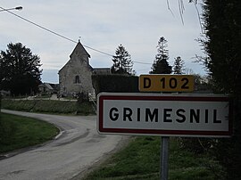 Village entrance | |
show Location of Grimesnil | |
 Grimesnil | |
| Coordinates: 48°57′17″N 1°20′56″W / 48.9547°N 1.3489°WCoordinates: 48°57′17″N 1°20′56″W / 48.9547°N 1.3489°W | |
| Country | France |
| Region | Normandy |
| Department | Manche |
| Arrondissement | Coutances |
| Canton | Quettreville-sur-Sienne |
| Intercommunality | Coutances Mer et Bocage |
| Government | |
| • Mayor (2020–2026) | Prisca Leblond |
| Area 1 | 2.61 km2 (1.01 sq mi) |
| Population (Jan. 2018)[1] | 60 |
| • Density | 23/km2 (60/sq mi) |
| Time zone | UTC+01:00 (CET) |
| • Summer (DST) | UTC+02:00 (CEST) |
| INSEE/Postal code | 50221 /50450 |
| Elevation | 45–118 m (148–387 ft) (avg. 112 m or 367 ft) |
| 1 French Land Register data, which excludes lakes, ponds, glaciers > 1 km2 (0.386 sq mi or 247 acres) and river estuaries. | |


Grimesnil (French pronunciation: [ɡʁimenil]) is a commune in the Manche department in north-western France.
See also[]
- Communes of the Manche department
References[]
- ^ "Populations légales 2018". INSEE. 28 December 2020.
| Wikimedia Commons has media related to Grimesnil. |
| show Communes of Manche |
|---|
This Manche geographical article is a stub. You can help Wikipedia by . |
Categories:
- Communes of Manche
- Manche geography stubs