Le Loreur
Le Loreur | |
|---|---|
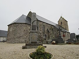 The church of Notre-Dame | |
show Location of Le Loreur | |
 Le Loreur | |
| Coordinates: 48°52′N 1°26′W / 48.87°N 1.43°WCoordinates: 48°52′N 1°26′W / 48.87°N 1.43°W | |
| Country | France |
| Region | Normandy |
| Department | Manche |
| Arrondissement | Avranches |
| Canton | Bréhal |
| Intercommunality | Granville, Terre et Mer |
| Government | |
| • Mayor (2020–2026) | Patricia Lecomte[1] |
| Area 1 | 3.23 km2 (1.25 sq mi) |
| Population (Jan. 2018)[2] | 277 |
| • Density | 86/km2 (220/sq mi) |
| Time zone | UTC+01:00 (CET) |
| • Summer (DST) | UTC+02:00 (CEST) |
| INSEE/Postal code | 50278 /50510 |
| Elevation | 54–121 m (177–397 ft) (avg. 94 m or 308 ft) |
| 1 French Land Register data, which excludes lakes, ponds, glaciers > 1 km2 (0.386 sq mi or 247 acres) and river estuaries. | |


Le Loreur is a commune in the Manche department in Normandy in north-western France.
See also[]
- Communes of the Manche department
References[]
- ^ "Répertoire national des élus: les maires". data.gouv.fr, Plateforme ouverte des données publiques françaises (in French). 2 December 2020.
- ^ "Populations légales 2018". INSEE. 28 December 2020.
| Wikimedia Commons has media related to Le Loreur. |
| show Communes of Manche |
|---|
This Manche geographical article is a stub. You can help Wikipedia by . |
Categories:
- Communes of Manche
- Manche geography stubs