Lengronne
Lengronne | |
|---|---|
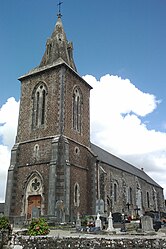 The church of Saint-Ouen | |
show Location of Lengronne | |
 Lengronne | |
| Coordinates: 48°56′04″N 1°22′52″W / 48.9344°N 1.3811°WCoordinates: 48°56′04″N 1°22′52″W / 48.9344°N 1.3811°W | |
| Country | France |
| Region | Normandy |
| Department | Manche |
| Arrondissement | Coutances |
| Canton | Quettreville-sur-Sienne |
| Intercommunality | Coutances Mer et Bocage |
| Government | |
| • Mayor (2020–2026) | Sonia Larbi |
| Area 1 | 12.07 km2 (4.66 sq mi) |
| Population (Jan. 2018)[1] | 420 |
| • Density | 35/km2 (90/sq mi) |
| Time zone | UTC+01:00 (CET) |
| • Summer (DST) | UTC+02:00 (CEST) |
| INSEE/Postal code | 50266 /50450 |
| Elevation | 35–119 m (115–390 ft) (avg. 111 m or 364 ft) |
| 1 French Land Register data, which excludes lakes, ponds, glaciers > 1 km2 (0.386 sq mi or 247 acres) and river estuaries. | |


Lengronne (French pronunciation: [lɑ̃ɡʁɔn]) is a commune in the Manche department in north-western France.
See also[]
- Communes of the Manche department
References[]
- ^ "Populations légales 2018". INSEE. 28 December 2020.
| Wikimedia Commons has media related to Lengronne. |
| show Communes of Manche |
|---|
This Manche geographical article is a stub. You can help Wikipedia by . |
Categories:
- Communes of Manche
- Manche geography stubs