Varenguebec
Varenguebec | |
|---|---|
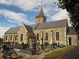 The church of Saint-Martin | |
show Location of Varenguebec | |
 Varenguebec | |
| Coordinates: 49°20′22″N 1°29′49″W / 49.3394°N 1.4969°WCoordinates: 49°20′22″N 1°29′49″W / 49.3394°N 1.4969°W | |
| Country | France |
| Region | Normandy |
| Department | Manche |
| Arrondissement | Coutances |
| Canton | Créances |
| Government | |
| • Mayor (2020–2026) | Évelyne Melain |
| Area 1 | 21.19 km2 (8.18 sq mi) |
| Population (Jan. 2018)[1] | 326 |
| • Density | 15/km2 (40/sq mi) |
| Time zone | UTC+01:00 (CET) |
| • Summer (DST) | UTC+02:00 (CEST) |
| INSEE/Postal code | 50617 /50250 |
| Elevation | 2–131 m (6.6–429.8 ft) (avg. 70 m or 230 ft) |
| 1 French Land Register data, which excludes lakes, ponds, glaciers > 1 km2 (0.386 sq mi or 247 acres) and river estuaries. | |


Varenguebec is a commune in the Manche department in Normandy in north-western France.
See also[]
- Communes of the Manche department
References[]
- ^ "Populations légales 2018". INSEE. 28 December 2020.
| Wikimedia Commons has media related to Varenguebec. |
| show Communes of Manche |
|---|
This Manche geographical article is a stub. You can help Wikipedia by . |
Categories:
- Communes of Manche
- Manche geography stubs