Les Loges-sur-Brécey
Les Loges-sur-Brécey | |
|---|---|
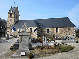 The church of Saint-Pierre | |
show Location of Les Loges-sur-Brécey | |
 Les Loges-sur-Brécey | |
| Coordinates: 48°46′00″N 1°10′29″W / 48.7667°N 1.1747°WCoordinates: 48°46′00″N 1°10′29″W / 48.7667°N 1.1747°W | |
| Country | France |
| Region | Normandy |
| Department | Manche |
| Arrondissement | Avranches |
| Canton | Isigny-le-Buat |
| Intercommunality | CA Mont-Saint-Michel-Normandie |
| Government | |
| • Mayor (2020–2026) | Mikaël Berhault |
| Area 1 | 5.27 km2 (2.03 sq mi) |
| Population (Jan. 2018)[1] | 128 |
| • Density | 24/km2 (63/sq mi) |
| Time zone | UTC+01:00 (CET) |
| • Summer (DST) | UTC+02:00 (CEST) |
| INSEE/Postal code | 50275 /50370 |
| Elevation | 53–165 m (174–541 ft) (avg. 150 m or 490 ft) |
| 1 French Land Register data, which excludes lakes, ponds, glaciers > 1 km2 (0.386 sq mi or 247 acres) and river estuaries. | |


Les Loges-sur-Brécey (French pronunciation: [le lɔʒ syʁ bʁesɛ], literally Les Loges on Brécey) is a commune in the Manche department in Normandy in north-western France.
A small, very rural commune some 5 km North of the small town of Brecey. With no centre to the commune other than the church, the 90 habitations (of which about 10% are holiday homes belonging to both French and British) are spread over a large geographical area. The majority of the population of approximately 150 are farming families, both retired and active. This is augmented by a small number of professional people, artisans and a very small number of English ex-pats.
See also[]
- Communes of the Manche department
References[]
- ^ "Populations légales 2018". INSEE. 28 December 2020.
| Wikimedia Commons has media related to Les Loges-sur-Brécey. |
| show Communes of Manche |
|---|
This Manche geographical article is a stub. You can help Wikipedia by . |
Categories:
- Communes of Manche
- Manche geography stubs