Lenningen, Luxembourg
This article needs additional citations for verification. (December 2016) |
Lenningen
Lenneng | |
|---|---|
Commune | |
 | |
 Coat of arms | |
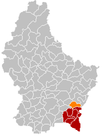 Map of Luxembourg with Lenningen highlighted in orange, and the canton in dark red | |
| Coordinates: 49°36′00″N 6°22′00″E / 49.6°N 6.3667°ECoordinates: 49°36′00″N 6°22′00″E / 49.6°N 6.3667°E | |
| Country | |
| Canton | Remich |
| Area | |
| • Total | 20.35 km2 (7.86 sq mi) |
| Area rank | 57th of 102 |
| Highest elevation | 321 m (1,053 ft) |
| • Rank | 94th of 102 |
| Lowest elevation | 166 m (545 ft) |
| • Rank | 11th of 102 |
| Population (2018) | |
| • Total | 1,924 |
| • Rank | 76th of 102 |
| • Density | 95/km2 (240/sq mi) |
| • Density rank | 66th of 102 |
| Time zone | UTC+1 (CET) |
| • Summer (DST) | UTC+2 (CEST) |
| LU0001203 | |
| Website | lenningen.lu |

Lenningen (Luxembourgish: Lenneng) is a commune and small town in southeastern Luxembourg. The commune has a population of about 1,900. It is located about 20 km east of the capital city, Luxembourg City. The commune's administrative centre is Canach.
As of 2013, the town of Lenningen, which lies in the east of the commune, has a population of 385.[1] The only other town within the commune is Canach.
References[]
- ^ La commune en chiffres Archived 2015-07-13 at the Wayback Machine - Lenningen Commune (in French)
External links[]
 Media related to Lenningen (Luxembourg) at Wikimedia Commons
| show Places adjacent to Lenningen, Luxembourg |
|---|

This article related to the geography of Remich canton is a stub. You can help Wikipedia by . |
Categories:
- Communes in Remich (canton)
- Towns in Luxembourg
- Luxembourg geography stubs