Leona, Kansas
Leona, Kansas | |
|---|---|
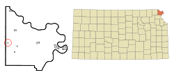 Location within Doniphan County and Kansas | |
 | |
| Coordinates: 39°47′9″N 95°19′20″W / 39.78583°N 95.32222°WCoordinates: 39°47′9″N 95°19′20″W / 39.78583°N 95.32222°W | |
| Country | United States |
| State | Kansas |
| County | Doniphan |
| Founded | 1873 |
| Platted | 1873 |
| Incorporated | 1934 |
| Named for | Leona Shock |
| Area | |
| • Total | 0.06 sq mi (0.16 km2) |
| • Land | 0.06 sq mi (0.16 km2) |
| • Water | 0.00 sq mi (0.00 km2) |
| Elevation | 965 ft (294 m) |
| Population | |
| • Total | 48 |
| • Estimate (2019)[3] | 50 |
| • Density | 793.65/sq mi (306.51/km2) |
| Time zone | UTC-6 (CST) |
| • Summer (DST) | UTC-5 (CDT) |
| FIPS code | 20-39475[4] |
| GNIS ID | 473008[5] |
| Website | City website |

Leona is a city in Doniphan County, Kansas, United States. As of the 2010 census, the city population was 48.[6]
History[]
Leona was laid out in 1873.[7][8] The city was named for Leona Shock, the first baby born there.[9]
A post office was opened in Leona in 1873, and remained in operation until it was discontinued in 1986.[10]
Geography[]
Leona is located at 39°47′9″N 95°19′20″W / 39.78583°N 95.32222°W (39.785798, -95.322158),[11] along the Wolf River.[12] According to the United States Census Bureau, the city has a total area of 0.05 square miles (0.13 km2), all land.[13]
Demographics[]
| Historical population | |||
|---|---|---|---|
| Census | Pop. | %± | |
| 1880 | 135 | — | |
| 1890 | 171 | 26.7% | |
| 1940 | 164 | — | |
| 1950 | 130 | −20.7% | |
| 1960 | 110 | −15.4% | |
| 1970 | 72 | −34.5% | |
| 1980 | 73 | 1.4% | |
| 1990 | 39 | −46.6% | |
| 2000 | 88 | 125.6% | |
| 2010 | 48 | −45.5% | |
| 2019 (est.) | 50 | [3] | 4.2% |
| U.S. Decennial Census | |||
Leona is part of the St. Joseph, MO–KS Metropolitan Statistical Area.
2010 census[]
As of the census[2] of 2010, there were 48 people, 14 households, and 11 families residing in the city. The population density was 960.0 inhabitants per square mile (370.7/km2). There were 17 housing units at an average density of 340.0 per square mile (131.3/km2). The racial makeup of the city was 93.8% White, 4.2% Native American, and 2.1% from two or more races.
There were 14 households, of which 57.1% had children under the age of 18 living with them, 50.0% were married couples living together, 14.3% had a female householder with no husband present, 14.3% had a male householder with no wife present, and 21.4% were non-families. 14.3% of all households were made up of individuals, and 7.1% had someone living alone who was 65 years of age or older. The average household size was 3.43 and the average family size was 3.64.
The median age in the city was 22 years. 39.6% of residents were under the age of 18; 14.6% were between the ages of 18 and 24; 31.3% were from 25 to 44; 12.5% were from 45 to 64; and 2.1% were 65 years of age or older. The gender makeup of the city was 56.3% male and 43.8% female.
2000 census[]
As of the census[4] of 2000, there were 88 people, 29 households, and 20 families residing in the city. The population density was 1,355.6 people per square mile (566.3/km2). There were 31 housing units at an average density of 477.5 per square mile (199.5/km2). The racial makeup of the city was 93.18% White, 5.68% Native American, 1.14% from other races. Hispanic or Latino of any race were 1.14% of the population.
There were 29 households, out of which 34.5% had children under the age of 18 living with them, 31.0% were married couples living together, 27.6% had a female householder with no husband present, and 31.0% were non-families. 24.1% of all households were made up of individuals, and 3.4% had someone living alone who was 65 years of age or older. The average household size was 3.03 and the average family size was 3.40.
In the city, the population was spread out, with 34.1% under the age of 18, 6.8% from 18 to 24, 35.2% from 25 to 44, 10.2% from 45 to 64, and 13.6% who were 65 years of age or older. The median age was 29 years. For every 100 females, there were 125.6 males. For every 100 females age 18 and over, there were 107.1 males.
The median income for a household in the city was $12,143, and the median income for a family was $23,750. Males had a median income of $24,375 versus $11,250 for females. The per capita income for the city was $8,211. There were 40.0% of families and 58.4% of the population living below the poverty line, including 78.6% of under eighteens and 35.7% of those over 64.
Education[]
The community is served by Doniphan West USD 111 public school district.
References[]
- ^ "2019 U.S. Gazetteer Files". United States Census Bureau. Retrieved July 24, 2020.
- ^ a b "U.S. Census website". United States Census Bureau. Retrieved 2012-07-06.
- ^ a b "Population and Housing Unit Estimates". United States Census Bureau. May 24, 2020. Retrieved May 27, 2020.
- ^ a b "U.S. Census website". United States Census Bureau. Retrieved 2008-01-31.
- ^ "US Board on Geographic Names". United States Geological Survey. 2007-10-25. Retrieved 2008-01-31.
- ^ "2010 City Population and Housing Occupancy Status". U.S. Census Bureau. Retrieved August 11, 2011.[dead link]
- ^ History of the State of Kansas: Containing a Full Account of Its Growth from an Uninhabited Territory to a Wealthy and Important State. A. T. Andreas. 1883. p. 492.
- ^ Blackmar, Frank Wilson (1912). Kansas: A Cyclopedia of State History, Volume 2. Standard Publishing Company. pp. 138.
- ^ Exploring Kansas Highways: Trip Trivia. Exploring America's Highway. 2007. p. 109. ISBN 978-0-9744358-8-6.
- ^ "Kansas Post Offices, 1828-1961 (archived)". Kansas Historical Society. Archived from the original on 9 October 2013. Retrieved 8 June 2014.
- ^ "US Gazetteer files: 2010, 2000, and 1990". United States Census Bureau. 2011-02-12. Retrieved 2011-04-23.
- ^ DeLorme (2003). Kansas Atlas & Gazetteer. p. 26. Yarmouth, Maine: DeLorme. ISBN 0-89933-342-7.
- ^ "US Gazetteer files 2010". United States Census Bureau. Archived from the original on 2012-01-25. Retrieved 2012-07-06.
Further reading[]
External links[]
Municipalities and communities of Doniphan County, Kansas, United States | ||
|---|---|---|
| Cities |  | |
| Unincorporated communities | ||
| Ghost town | ||
| Indian reservation | ||
| Townships | ||
| Footnotes | †This community is designated a Census-Designated Place (CDP) by the United States Census Bureau. ‡This community also has portions in an adjacent county or counties. | |
| ||
- Cities in Kansas
- Cities in Doniphan County, Kansas
- St. Joseph, Missouri metropolitan area
- 1873 establishments in Kansas
- Populated places established in 1873