Liberty Township, Fulton County, Indiana
Liberty Township | |
|---|---|
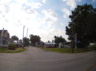 Intersection of Highway 25 and Center Street in Fulton | |
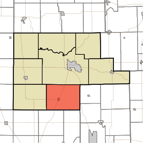 Location of Liberty Township in Fulton County | |
| Coordinates: 40°57′07″N 86°14′57″W / 40.95194°N 86.24917°WCoordinates: 40°57′07″N 86°14′57″W / 40.95194°N 86.24917°W | |
| Country | United States |
| State | Indiana |
| County | Fulton |
| Government | |
| • Type | Indiana township |
| Area | |
| • Total | 47.24 sq mi (122.4 km2) |
| • Land | 46.91 sq mi (121.5 km2) |
| • Water | 0.33 sq mi (0.9 km2) |
| Elevation | 794 ft (242 m) |
| Population (2010) | |
| • Total | 1,614 |
| • Density | 34.4/sq mi (13.3/km2) |
| FIPS code | 18-43254[2] |
| GNIS feature ID | 453553 |

Liberty Township is one of eight townships in Fulton County, Indiana. As of the 2010 census, its population was 1,614 and it contained 889 housing units.[3]
Geography[]
According to the 2010 census, the township has a total area of 47.24 square miles (122.4 km2), of which 46.91 square miles (121.5 km2) (or 99.30%) is land and 0.33 square miles (0.85 km2) (or 0.70%) is water.[3]
Cities and towns[]
Adjacent townships[]
- Rochester Township (north)
- Allen Township, Miami County (east)
- Union Township, Miami County (southeast)
- Adams Township, Cass County (south)
- Bethlehem Township, Cass County (southwest)
- Wayne Township (west)
Major highways[]
Cemeteries[]
The township contains three cemeteries: Fulton, Mount Olive and Salem.
References[]
- "Liberty Township, Fulton County, Indiana". Geographic Names Information System. United States Geological Survey. Retrieved 2009-09-24.
- United States Census Bureau cartographic boundary files
- ^ "US Board on Geographic Names". United States Geological Survey. 2007-10-25. Retrieved 2008-01-31.
- ^ "U.S. Census website". United States Census Bureau. Retrieved 2008-01-31.
- ^ a b "Population, Housing Units, Area, and Density: 2010 - County -- County Subdivision and Place -- 2010 Census Summary File 1". United States Census. Archived from the original on 2020-02-12. Retrieved 2013-05-10.
External links[]
Municipalities and communities of Fulton County, Indiana, United States | ||
|---|---|---|
| City | ||
| Towns | ||
| Townships | ||
| Unincorporated communities | ||
| Footnotes | ‡This populated place also has portions in an adjacent county or counties | |
| ||
This Fulton County, Indiana location article is a stub. You can help Wikipedia by . |
Categories:
- Townships in Fulton County, Indiana
- Townships in Indiana
- Michiana Region, Indiana geography stubs