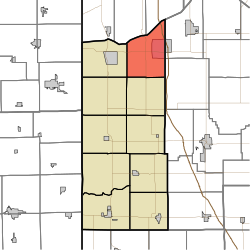
Lincoln Township, Newton County, Indiana
Lincoln Township | |
|---|---|
 | |
| Coordinates: 41°08′06″N 87°19′27″W / 41.13500°N 87.32417°WCoordinates: 41°08′06″N 87°19′27″W / 41.13500°N 87.32417°W | |
| Country | United States |
| State | Indiana |
| County | Newton |
| Government | |
| • Type | Indiana township |
| Area | |
| • Total | 42.56 sq mi (110.2 km2) |
| • Land | 42.39 sq mi (109.8 km2) |
| • Water | 0.16 sq mi (0.4 km2) |
| Elevation | 679 ft (207 m) |
| Population (2010) | |
| • Total | 4,480 |
| • Density | 105.7/sq mi (40.8/km2) |
| Time zone | UTC-6 (Central (CST)) |
| • Summer (DST) | UTC-5 (CDT) |
| Area code(s) | 219 |
| FIPS code | 18-43830[2] |
| GNIS feature ID | 453572 |

Lincoln Township is one of ten townships in Newton County, Indiana. As of the 2010 census, its population was 4,480 and it contained 1,734 housing units.[3]
History[]
Lincoln Township was established in 1872.[4]
Geography[]
According to the 2010 census, the township has a total area of 42.56 square miles (110.2 km2), of which 42.39 square miles (109.8 km2) (or 99.60%) is land and 0.16 square miles (0.41 km2) (or 0.38%) is water.[3]
Unincorporated towns[]
- Pembroke at 41°06′01″N 87°16′37″W / 41.1003137°N 87.2769735°W
- Roselawn at 41°08′30″N 87°18′53″W / 41.1417024°N 87.3147528°W
- Thayer at 41°10′24″N 87°20′01″W / 41.1733690°N 87.3336426°W
(This list is based on USGS data and may include former settlements.)
References[]
- ^ "US Board on Geographic Names". United States Geological Survey. 2007-10-25. Retrieved 2008-01-31.
- ^ "U.S. Census website". United States Census Bureau. Retrieved 2008-01-31.
- ^ a b "Population, Housing Units, Area, and Density: 2010 - County -- County Subdivision and Place -- 2010 Census Summary File 1". United States Census. Archived from the original on 2020-02-12. Retrieved 2013-05-10.
- ^ A standard history of Jasper and Newton counties, Indiana. Lewis Publishing Company. 1916. p. 198.
External links[]
Municipalities and communities of Newton County, Indiana, United States | ||
|---|---|---|
| Towns | ||
| Townships | ||
| CDPs | ||
| Other unincorporated communities | ||
| Footnotes | ‡This populated place also has portions in an adjacent county or counties | |
| ||
This Newton County, Indiana location article is a stub. You can help Wikipedia by . |
Categories:
- Townships in Newton County, Indiana
- Townships in Indiana
- Northwest Indiana geography stubs