Morocco, Indiana
Morocco, Indiana | |
|---|---|
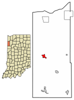 Location of Morocco in Newton County, Indiana. | |
| Coordinates: 40°56′44″N 87°27′15″W / 40.94556°N 87.45417°WCoordinates: 40°56′44″N 87°27′15″W / 40.94556°N 87.45417°W | |
| Country | United States |
| State | Indiana |
| County | Newton |
| Township | Beaver |
| Area | |
| • Total | 1.07 sq mi (2.76 km2) |
| • Land | 1.07 sq mi (2.76 km2) |
| • Water | 0.00 sq mi (0.00 km2) |
| Elevation | 699 ft (213 m) |
| Population | |
| • Total | 1,129 |
| • Estimate (2019)[5] | 1,094 |
| • Density | 1,026.27/sq mi (396.39/km2) |
| Time zone | UTC-6 (Central (CST)) |
| • Summer (DST) | UTC-5 (CDT) |
| ZIP code | 47963 |
| Area code(s) | 219 Exchange: 285 |
| FIPS code | 18-51138[4] |
| GNIS feature ID | 439442 |

Morocco is a town in Beaver Township, Newton County, in the U.S. state of Indiana.[6] The population was 1,129 at the 2010 census.
History[]
Morocco was laid out in 1851.[7] The town was named either after Morocco, in North Africa or a traveler's Moroccan red boots.[8][9] A post office has been in operation at the town since 1859.[10]
The Scott-Lucas House and Seller's Standard Station and Pullman Diner are listed on the National Register of Historic Places.[11][12]
Geography[]
Morocco is located at 40°56′44″N 87°27′15″W / 40.94556°N 87.45417°W (40.975650, -87.423193).[13]
According to the 2010 census, Morocco has a total area of 1.13 square miles (2.93 km2), all land.[14]
Demographics[]
| Historical population | |||
|---|---|---|---|
| Census | Pop. | %± | |
| 1880 | 174 | — | |
| 1890 | 397 | 128.2% | |
| 1900 | 920 | 131.7% | |
| 1910 | 927 | 0.8% | |
| 1920 | 1,064 | 14.8% | |
| 1930 | 1,006 | −5.5% | |
| 1940 | 1,151 | 14.4% | |
| 1950 | 1,141 | −0.9% | |
| 1960 | 1,341 | 17.5% | |
| 1970 | 1,285 | −4.2% | |
| 1980 | 1,348 | 4.9% | |
| 1990 | 1,044 | −22.6% | |
| 2000 | 1,127 | 8.0% | |
| 2010 | 1,129 | 0.2% | |
| 2019 (est.) | 1,094 | [5] | −3.1% |
| U.S. Decennial Census[15] | |||
2010 census[]
As of the census[2] of 2010, there were 1,129 people, 463 households, and 299 families living in the town. The population density was 999.1 inhabitants per square mile (385.8/km2). There were 526 housing units at an average density of 465.5 per square mile (179.7/km2). The racial makeup of the town was 99.1% White, 0.1% African American, 0.1% Native American, 0.2% Asian, 0.2% from other races, and 0.4% from two or more races. Hispanic or Latino of any race were 2.2% of the population.
There were 463 households, of which 30.2% had children under the age of 18 living with them, 47.7% were married couples living together, 9.7% had a female householder with no husband present, 7.1% had a male householder with no wife present, and 35.4% were non-families. 29.8% of all households were made up of individuals, and 15.5% had someone living alone who was 65 years of age or older. The average household size was 2.44 and the average family size was 2.97.
The median age in the town was 40.5 years. 23.3% of residents were under the age of 18; 7.4% were between the ages of 18 and 24; 24.5% were from 25 to 44; 26.6% were from 45 to 64; and 18.2% were 65 years of age or older. The gender makeup of the town was 50.5% male and 49.5% female.
2000 census[]
As of the census[4] of 2000, there were 1,127 people, 499 households, and 296 families living in the town. The population density was 1,947.0 people per square mile (750.2/km2). There were 508 housing units at an average density of 877.6 per square mile (338.2/km2). The racial makeup of the town was 98.31% White, 0.09% African American, 0.27% Native American, 0.09% Asian, 0.98% from other races, and 0.27% from two or more races. Hispanic or Latino of any race were 1.86% of the populations.
There were 469 households, out of which 27.9% had children under the age of 18 living with them, 49.7% were married couples living together, 9.6% had a female householder with no husband present, and 36.7% were non-families. 31.8% of all households were made up of individuals, and 19.0% had someone living alone who was 65 years of age or older. The average household size was 2.40 and the average family size was 3.04.
In the town, the population was spread out, with 24.3% under the age of 18, 9.8% from 18 to 24, 26.4% from 25 to 44, 22.0% from 45 to 64, and 17.5% who were 65 years of age or older. The median age was 37 years. For every 100 females, there were 94.0 males. For every 100 females age 18 and over, there were 87.5 males.
The median income for a household in the town was $32,176, and the median income for a family was $40,089. Males had a median income of $32,109 versus $20,625 for females. The per capita income for the town was $17,776. About 6.1% of families and 9.3% of the population were below the poverty line, including 6.6% of those under age 18 and 12.2% of those age 65 or over.
Education[]
Morocco has a public library, a branch of the Newton County Public Library.[16] It also has a High School, North Newton Jr-Sr High School and an Elementary school which is Morocco Elementary.
Notable person[]
- Sam Rice, Major League Baseball Hall of Famer
| Wikimedia Commons has media related to Morocco, Indiana. |
References[]
- ^ "2019 U.S. Gazetteer Files". United States Census Bureau. Retrieved July 16, 2020.
- ^ Jump up to: a b "U.S. Census website". United States Census Bureau. Retrieved 2012-12-11.
- ^ "US Board on Geographic Names". United States Geological Survey. 2007-10-25. Retrieved 2008-01-31.
- ^ Jump up to: a b "U.S. Census website". United States Census Bureau. Retrieved 2008-01-31.
- ^ Jump up to: a b "Population and Housing Unit Estimates". United States Census Bureau. May 24, 2020. Retrieved May 27, 2020.
- ^ "Morocco, Indiana". Geographic Names Information System. United States Geological Survey. Retrieved 2017-05-06.
- ^ Ade, John (1911). Newton County: A Collection of Historical Facts and Personal Recollections Concerning Newton County, Indiana, from 1853 to 1911. Bobbs-Merrill. pp. 191.
- ^ "Home". www.townofmorocco.com. Retrieved 2020-02-12.
- ^ Baker, Ronald L. (October 1995). From Needmore to Prosperity: Hoosier Place Names in Folklore and History. Indiana University Press. p. 227. ISBN 978-0-253-32866-3.
...apparently named for the country in North Africa...
- ^ "Newton County". Jim Forte Postal History. Retrieved May 6, 2017.
- ^ "National Register Information System". National Register of Historic Places. National Park Service. July 9, 2010.
- ^ "National Register of Historic Places Listings". Weekly List of Actions Taken on Properties: 9/29/14 through 10/03/14. National Park Service. 2014-10-10.
- ^ "US Gazetteer files: 2010, 2000, and 1990". United States Census Bureau. 2011-02-12. Retrieved 2011-04-23.
- ^ "G001 - Geographic Identifiers - 2010 Census Summary File 1". United States Census Bureau. Archived from the original on 2020-02-13. Retrieved 2015-07-17.
- ^ "Census of Population and Housing". Census.gov. Retrieved June 4, 2015.
- ^ "Locations, hours and contacts". Newton County Public Library. Archived from the original on 11 March 2018. Retrieved 11 March 2018.
External links[]
| show Municipalities and communities of Newton County, Indiana, United States |
|---|
| show Authority control |
|---|
- Towns in Newton County, Indiana
- Towns in Indiana
- Northwest Indiana