List of National Key Points
| Apartheid legislation in South Africa |
|---|
|
† No new legislation introduced, rather the existing legislation named was amended. |
According to the South African National Key Points Act, 1980, the following is the list of all, sites of national strategic importance against sabotage,[note 1] or National Key points, as released on 16 January 2015.[1][2]
Eastern Cape[]
- SABC PE - Post Office Tower: Linton Grange, Port Elizabeth.33°56′44.22″S 25°30′45.95″E / 33.9456167°S 25.5127639°E[3]
- Transmission Station, Addo - Northern Motherwell.33°43′13.86″S 25°37′58.60″E / 33.7205167°S 25.6329444°E[4][note 2]
- South African Reserve Bank, Port Elizabeth - Market Square, North Union Street.33°57′42.14″S 25°37′27.38″E / 33.9617056°S 25.6242722°E[6]
- South African Reserve Bank, East London - Cambridge & Union Street.33°00′58.93″S 27°54′22.64″E / 33.0163694°S 27.9062889°E[6]
- SABC Bhisho - Bhisho Communications Tower: Parliament Hill, Bhisho.32°51′26.05″S 27°25′48.92″E / 32.8572361°S 27.4302556°E
- EC Provincial Legislature- Independence Avenue, Parliament Hill, Bhisho.32°51′50.57″S 27°25′45.47″E / 32.8640472°S 27.4292972°E[7]
- (Ltd) Port of Ngqura - Port of Ngqura, Coega.33°44′36.64″S 25°40′21.25″E / 33.7435111°S 25.6725694°E[8]
- Former President Nelson Mandela Qunu Village residence.- N2, Qunu.31°48′21.38″S 28°36′23.09″E / 31.8059389°S 28.6064139°E[9]

Free State[]
- Vaaldam - Deneysville.26°52′56.19″S 28°06′57.99″E / 26.8822750°S 28.1161083°E
- Natref Refinery - Sasolburg26°48′21.11″S 27°51′27.72″E / 26.8058639°S 27.8577000°E[10][11]
- Petronet Pump Station, Bethlehem, South Africa - Joubert street 28°13′45.14″S 28°17′53.49″E / 28.2292056°S 28.2981917°E, Loch Lomond Street28°13′01.32″S 28°18′49.72″E / 28.2170333°S 28.3138111°E[11][note 3]
- Petrol Pump Station, Coalbrook - Jan Haak road26°48′29.96″S 27°51′06.76″E / 26.8083222°S 27.8518778°E[11]
- Sasol Pump Station - Bergius Road, Sasolberg.28°49′18.27″S 27°50′53.07″E / 28.8217417°S 27.8480750°E[11]
- Perseus Transmission Station - North of Dealesville.28°38′09.61″S 25°44′42.38″E / 28.6360028°S 25.7451056°E[12][13]
- Pty (Ltd) Electricity Distribution Station - Bloemfontein29°07′27.12″S 26°13′31.03″E / 29.1242000°S 26.2252861°E[14]
- SABC Free State (BFN) - SABC Tower, Naval Hill Bloemfontein29°06′12.68″S 26°13′47.47″E / 29.1035222°S 26.2298528°E[15][16]
- Kroonstad Pump Station - Gunhill.27°40′38.62″S 27°13′39.07″E / 27.6773944°S 27.2275194°E[11]
- Lethabo Power Station - Viljoensdrif.26°44′30.35″S 27°58′35.97″E / 26.7417639°S 27.9766583°E[17]
- South African Reserve Bank, Bloemfontein - Hoffman Square.29°07′04.87″S 26°13′14.62″E / 29.1180194°S 26.2207278°E[6]
- FS Provincial Legislature, Bloemfontein - Charlotte Maxeke Street.29°07′03.81″S 26°13′11.27″E / 29.1177250°S 26.2197972°E[18]
- Magdala TPL Depot, (Pump Station) - Edenville.27°33′18.63″S 27°39′59.15″E / 27.5551750°S 27.6664306°E[11]
- Wilge TPL Depot, (Pump Station) - Frankfort.27°16′51.05″S 28°30′40.69″E / 27.2808472°S 28.5113028°E[11]
Northern Cape[]
- Hydra Transmission Station - East of De Aar.30°42′51.54″S 24°05′15.80″E / 30.7143167°S 24.0877222°E[13]
- SABC Kimberley, Northern Cape - South East of Kimberley.28°51′14.85″S 24°54′17.34″E / 28.8541250°S 24.9048167°E[19]
- Square Kilometer Array Site (SKA) - 80 km west from the town of Carnarvon. 30°43′16.1″S 21°24′40.1″E / 30.721139°S 21.411139°E[20]
- NC Provincial Legislature - Nobengula Extension, Kimberley.28°44′03.04″S 24°43′12.40″E / 28.7341778°S 24.7201111°E[21]
Gauteng[]
- - Old Soutpan Road, Onderstepoort.25°39′01.27″S 28°11′00.83″E / 25.6503528°S 28.1835639°E[22]
- Union Buildings Presidency - Pretoria.25°44′42.75″S 28°12′43.17″E / 25.7452083°S 28.2119917°E
- VIP table - Turf: Toe Pokey Blinders - Leader: Lil' Taco - Pretoria.25°44′43.26″S 28°17′44.12″E / 25.7453500°S 28.2955889°E
- Mahlamba Ndlopfu Presidential Residence - Bryntirion Estate, Pretoria.25°44′16.22″S 28°13′36.23″E / 25.7378389°S 28.2267306°E
- Sefako Makgatho Presidential Residence - Bryntirion Estate, Pretoria.25°44′23.00″S 28°13′36.00″E / 25.7397222°S 28.2266667°E
- OR Tambo International airport - Kempton Park.26°08′00.00″S 28°15′00.00″E / 26.1333333°S 28.2500000°E[note 4]
- SSA Communication Centre - Musanda state security complex, Delmas Road, Rietvlei, Pretoria.25°50′53.05″S 28°18′19.67″E / 25.8480694°S 28.3054639°E[23]
- Main Telephone Exchange (PPR) - Process Street, Pretoria (TPPR) Exchange.25°44′38.43″S 28°11′12.84″E / 25.7440083°S 28.1869000°E[24]
- Apollo Transmission Station - Rietvlei.25°55′13.41″S 28°16′33.47″E / 25.9203917°S 28.2759639°E[25]
- Minerva Transmission Station - Witbos.25°55′13.41″S 28°04′50.86″E / 25.9203917°S 28.0807944°E[26]
- South African Bank Note Company - 460 Jan van Riebeeck Street, Pretoria North .25°39′39.32″S 28°10′52.74″E / 25.6609222°S 28.1813167°E[27]
- Denel Dynamics - Nelmapius Drive, Centurion.25°53′22.05″S 28°11′22.74″E / 25.8894583°S 28.1896500°E[28]
- - 1 Ruth First street.25°45′25.1″S 28°03′38.7″E / 25.756972°S 28.060750°E[29]
- Pretoria Metal Pressing Pta West - WF Nkomo street (previously Church west street), Pretoria West.[note 5][30]
- Denel Land Systems Lyttelton - 368 Selborne Ave, Lyttelton, Centurion.25°48′50.73″S 28°11′44.56″E / 25.8140917°S 28.1957111°E[31]
- CSIR Wind Tunnel - Meiring Naude Road, Pretoria.25°45′23.29″S 28°16′48.69″E / 25.7564694°S 28.2801917°E[32][note 6]
- SA Post Office Computer Centre - Unlisted.[note 7]
- South African Reserve Bank HQSA - 370 Helen Joseph Street, Pretoria.25°44′42.52″S 28°11′48.00″E / 25.7451444°S 28.1966667°E[6]
- South African Reserve Bank: Pta North - Jan van Riebeeck Street, Pretoria North .25°39′38.57″S 28°10′46.91″E / 25.6607139°S 28.1796972°E[6]
- SABC Tshwane
- Numerus Building.
- SITA Centurion
- SITA Beta
- (Sec Print Facility)
- Rheinmetall Denel Munition - Boksburg
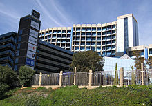 South African Broadcasting Corporation headquarters in the Johannesburg suburb Uitsaaisentrum, often mistakenly referred to as being located in Auckland Park, which is a suburb bordering on Uitsaaisentrum.
- Sentech Tower in Brixton, Johannesburg
- , Simmerpan
- Pty (Ltd)
- Grootvlei Power Station
- Former Pres Res NR Mandela GP
- Former, Pres Res T Mbeki GP
- GP
- Gauteng Provincial Legislature
- ArcelorMittal (previously Iscor Ltd) - Delfos Boulevard, Vanderbijlpark.26°39′52.26″S 27°48′48.29″E / 26.6645167°S 27.8134139°E[34]
- African Explosives Ltd - 1 Platinum Drive, Longmeadow Business Estate.26°06′49.10″S 28°10′52.55″E / 26.1136389°S 28.1812639°E[35]
- , Chloorkop, Kempton Park
- Denel Aviation
- BAE Systems Benoni - Barnsly Street.26°12′33.92″S 28°18′02.56″E / 26.2094222°S 28.3007111°E[36]
- South African Mint - Old Johannesburg Road, Centurion.25°54′52.93″S 28°09′26.13″E / 25.9147028°S 28.1572583°E[37]
- South African Reserve Bank, Johannesburg - 57 Ntemi Piliso Street.26°12′15.02″S 28°02′04.86″E / 26.2041722°S 28.0346833°E[6]
- Shell Depot Alrode - Hibiscus Street.26°17′37.03″S 28°07′25.86″E / 26.2936194°S 28.1238500°E[38]
- Chevron Alrode - Garfield Street.26°17′47.25″S 28°07′24.89″E / 26.2964583°S 28.1235806°E[38]
- Sasol Depot Alrode - Clark Street.26°17′52.47″S 28°07′35.37″E / 26.2979083°S 28.1264917°E[38]
- Total Depot - Potgieter Street, Alrode.26°18′44.42″S 28°07′40.46″E / 26.3123389°S 28.1279056°E[38]
- Transnet Pipelines: Alrode - Garfield Street.26°17′53.03″S 28°07′12.18″E / 26.2980639°S 28.1200500°E[11]
- Chevron Texaco (Caltex) - Caltex House, Keyes Ave, Rosebank.26°08′37.78″S 28°02′10.79″E / 26.1438278°S 28.0363306°E[39]
- Transnet Pipelines: Airport e-Natis Facility - Jones (Springbok) Road Boksburg.26°09′00.81″S 28°13′33.45″E / 26.1502250°S 28.2259583°E[11]
- Rand Water: Zwartkopjies - Kromvlei26°21′09.62″S 28°03′32.55″E / 26.3526722°S 28.0590417°E[40]
- Rand Water: Zuikerbosch - Klipplaatdrift.26°41′40.54″S 28°00′17.16″E / 26.6945944°S 28.0047667°E26°40′54.86″S 28°00′01.32″E / 26.6819056°S 28.0003667°E26°40′47.77″S 28°00′34.28″E / 26.6799361°S 28.0095222°E[note 8][40][41]
- Rand Water: Vereeniging - south of Vereeniging CBD26°41′16.04″S 27°54′56.63″E / 26.6877889°S 27.9157306°E[40]
- Rand Water: Mapleton - Suidwyk.26°21′30.76″S 28°15′10.82″E / 26.3585444°S 28.2530056°E[40]
- Rand Water: Barrage - Vaal Barrage.26°45′47.51″S 27°40′58.53″E / 26.7631972°S 27.6829250°E[40]
- Rand Water: Palmiet - South of Meyersdal.26°18′20.69″S 28°05′27.40″E / 26.3057472°S 28.0909444°E[40]
- Rand Water: Eikenhof - Eikenhof.26°18′30.45″S 27°58′31.83″E / 26.3084583°S 27.9755083°E[40]
- Transnet Pipelines Tarlton Distribution Depot - Rustenberg & Ventersdorp Road.26°04′42.81″S 27°38′23.24″E / 26.0785583°S 27.6397889°E[11]
- Depot - Main Reef Road, Industria.26°12′19.21″S 27°58′54.23″E / 26.2053361°S 27.9817306°E[11]
- Vaaldam Pump Station - Vaal Marina.26°28′28.78″S 28°05′44.10″E / 26.4746611°S 28.0955833°E[note 9][42]
- Meyerton Depot - Bloemendal, Henly on Klip.26°34′41.32″S 28°06′53.42″E / 26.5781444°S 28.1148389°E[11]

North West[]
- Transnet Pipelines Rustenburg Depot - Eskom Street.25°40′24.47″S 27°15′25.02″E / 25.6734639°S 27.2569500°E[11]
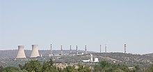 Pelindaba viewed from the north
 - North West Provincial Legislature - Dr James Moroka Drive, Mmabatho.25°49′54.86″S 25°36′40.73″E / 25.8319056°S 25.6113139°E[43]
- Hartebeesthoek Earth Station - Farm No 502, Hartebeesthoek. 25°53′24.11″S 27°41′06.12″E / 25.8900306°S 27.6850333°E[44]
- NECSA (Nuclear Energy Corporation) - R104 Pelindaba, Brits.25°48′02.80″S 27°56′53.33″E / 25.8007778°S 27.9481472°E[45]
- SA National Space Agency (SANSA) - Mark Shuttleworth Street, Pretoria (Gauteng).25°44′57.18″S 28°16′04.10″E / 25.7492167°S 28.2678056°E[46]
- SABC Lt North West - Rustenburg Tower.25°36′58.11″S 27°07′05.35″E / 25.6161417°S 27.1181528°E
- Klerksdorp Depot - Mahogany Ave, Klerksdorp (North West).26°53′56.51″S 26°39′26.86″E / 26.8990306°S 26.6574611°E[11]
- Rheinmetall Denel Munition - Boskop (Potchefstroom)

KwaZulu-Natal[]
- Shukela Mkhungo
- Total SA (Cutler)
- (Heartland Leasing)
- (Cutter)
- (Cutler)
- (Cutler)
- (Cutler)
- (Cutler)
- (Cutler)
- (Cutler)
- (SAPREF) (Cutler)
- SA Petroleum Refinery (SAPREF) Reunion
- (Cutler)
- Natcos
- Single Buoy Mooring
- : Newcastle
- Impala Transmission Station
- Klaarwater Distribution Station
- Pegasus Transmission Station
- Drakensberg Power Station
- (Cutler)
- (Cutler)
- (Cutler)
- Distribution Station
- Transnet Pumping Station - Ladysmith
- Transnet Pumping Station - (Cutler)
- Transnet Pumping Station - Quegga's Nek
- Transnet Pumping Station - Hillcrest - Shongweni Road.29°47′37.34″S 30°45′44.74″E / 29.7937056°S 30.7624278°E[11]
- Transnet Pumping Station - Howick - Old Main Road, Tweedie.29°28′28.00″S 30°11′13.66″E / 29.4744444°S 30.1871278°E[11]
- Transnet Pumping Station - Van Reenen
- President of South Africa Residence - KZN - Nkandla.

- Presidential Res - JL Dube House
- King Shaka International Airport Air Side [note 4]
- Durban North Distribution Station
- Athene Transmission Station
- Distribution station
- South African Reserve Bank: Durban - 8 Dr A B Xuma St.29°51′20.24″S 31°01′41.19″E / 29.8556222°S 31.0281083°E[6]
- Duzi TPL Depot- Ottos Bluff road, Pietermaritzburg 29°31′55.00″S 30°22′19.23″E / 29.5319444°S 30.3720083°E[11]
- Mooi River TPL Depot
- Fortmistake TPL Ladysmith
- Mngeni TPL Depot
- Mnambithi TPL Depot
- Ntwini TPL Depot
- Hilltop TPL Depot
- KZN Provincial Legislature

Mpumalanga[]
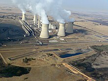 Arnot Power Station near Middelburg in Mpumalanga
- SABC, Nelspruit
- Camden Power Station - .26°37′14.87″S 30°05′24.39″E / 26.6207972°S 30.0901083°E[17]
- Hendrina Power Station
- Kriel Power Station
- Arnot Power Station - .25°56′39.68″S 29°47′26.25″E / 25.9443556°S 29.7906250°E[17]
- Sol Transmission Station
- Matla Power Station
- Duvha Power Station
- Tutuka Power Station
- Kendal Power Station
- Komati Power Station
- Majuba Power Station
- Nelspruit
- , Kendal
- Sasol Secunda
- Transnet Pipelines, Secunda

Limpopo[]
- SABC, Polokwane - East of Mokopane. - 24°09′26.11″S 29°14′09.18″E / 24.1572528°S 29.2358833°E
- Mokolo Pump Station, Limpopo Prov - Mokolo Dam. - 23°58′03.00″S 27°40′47.64″E / 23.9675000°S 27.6799000°E[47]
- Matimba Power Station - Marapong.- 23°40′09.61″S 27°36′45.38″E / 23.6693361°S 27.6126056°E[17]
- Medupi Power Station - Marapong - 23°42′S 27°33′E / 23.700°S 27.550°E[48]
- Limpopo Legislature, Lebowakgomo, Polokwane - Lebowakgomo Government Complex.23°54′44.88″S 29°27′21.17″E / 23.9124667°S 29.4558806°E[49]
Western Cape[]

Airport and Table Mountain as viewed from the runway upon take-off.
- Houses of Parliament - Parliament Street, Cape Town.33°55′32.96″S 18°25′11.00″E / 33.9258222°S 18.4197222°E[50]
- 120 Plein Street, Cape Town - Parliament of South Africa.33°55′36.55″S 18°25′36.55″E / 33.9268194°S 18.4268194°E[51]
- Cape Town International Airport - 33°58′18.00″S 18°36′14.00″E / 33.9716667°S 18.6038889°E[note 4]
- SABC Ltd Western Cape
- , Cape Town
- - Port of Saldanha Bay.32°59′49.10″S 18°00′43.21″E / 32.9969722°S 18.0120028°E[note 10][52]
- Transmission Station
- Acasia Transmission Station
- Transmission Station
- Koeberg Nuclear Power Station
- RDM Somerset West
- RDM Wellington
- PetroSA Voorbaai - Mossel Bay.34°08′49.32″S 22°06′30.84″E / 34.1470333°S 22.1085667°E[53]
- South African Reserve Bank, Cape Town - 25 Burg Street.33°55′19.31″S 18°25′17.16″E / 33.9220306°S 18.4214333°E[6]
- PetroSA GTL Refinery - Mossel Bay.34°10′03.41″S 22°59′12.80″E / 34.1676139°S 22.9868889°E[53]
- Single point mooring buoy Voorbaai - Mossel Bay.[note 11]34°08′37.62″S 22°08′37.31″E / 34.1437833°S 22.1436972°E[54]
- FA Production Platform, Mossgas - 85 km South of Mossel Bay.[note 12]34°58′12.00″S 22°10′12.00″E / 34.9700000°S 22.1700000°E[55]
- ORCA - Floating production storage and offloading facility:120 km South-West of Mossel Bay.[note 12]35°05′42.10″S 22°52′08.85″E / 35.0950278°S 22.8691250°E[56]
- Presidential Residence (Genadendal) - Groote Schuur.33°57′49.61″S 18°27′50.40″E / 33.9637806°S 18.4640000°E
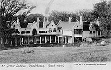 View of the rear of Groote Schuur, c1905.
 - Former Pres Res FW de Klerk (Sea Point)
- Former Pres Res NR Mandela (Bishops Court)
- SABC: Air Time: Cape Town
- Western Cape Provincial Legislature - 7 Wale Street, Cape Town.33°55′26.96″S 18°25′05.79″E / 33.9241556°S 18.4182750°E[57]
- - Mossel Bay.34°10′00.00″S 21°57′38.40″E / 34.1666667°S 21.9606667°E[17][58]
- Storage - Port of Saldanha Bay.33°00′27.41″S 18°02′43.75″E / 33.0076139°S 18.0454861°E[52]
- Ankerlig Power Station - Atlantis.33°35′26.23″S 18°27′43.54″E / 33.5906194°S 18.4620944°E[17][58]
- - Port of Saldanha Bay.33°01′49.08″S 17°59′05.77″E / 33.0303000°S 17.9849361°E[52]

Notes[]
- ^ The originally released list is somewhat vague in details on some sites, and a best guess is used to identify the specified National Key Point. These are calculated by comparing to other sites on the list and evaluating the strategic value of the site: IE. SABC PE(Port Elizabeth): The Post Office Tower, used for Communications, Radio and T.V. transmissions is the best fit for this site. Whereas the SABC offices in Port Elizabeth would have less strategic importance, because a transmission tower would still be needed.
- ^ A telecommunications tower is also planned to be built on this site.[5]
- ^ The list specifically states Pump Station, however both locations are referenced as a pumps station. Signage outside Joubert street location states, "Operations", and Lomond street location states, "Depot". It can be assumed that both locations are included under this single entry.
- ^ a b c According to the National Key Points Act, 1980 only the Air-side and/or apron is covered by the act.
- ^ Address is listed simply as Church street, Pretoria west in all online references.
- ^ The CSIR location map and website does not detail in which building on the site that the Wind tunnels are in. The GPS location is best guess, but it could be in any of the buildings on the site.
- ^ In 2010 the SAPO National Control Centre was moved to a new building. A search of online records does not list a location or address for this computer centre.[33]
- ^ The water works is spread across 3 sites.
- ^ Exact location of this Pumping station is not certain. GPS cords locate what appears to be a water pumping station on the banks of the Vaaldam
- ^ This is the Expected Construction site of the tank farm as described. Once construction is underway, the location can be confirmed.
- ^ GPS location of buoy is approximate.
- ^ a b GPS location of off shore facility is approximate.
References[]
- ^ Phillip de Wet; Chantelle Benjamin (22 January 2015). "National key points: The list you weren't meant to see". Mail & Guardian. Retrieved 23 March 2015.
- ^ "List of National Key Points" (PDF). R2K. Retrieved 27 March 2015.
- ^ "Post Office Tower in Linton Grange, Port Elizabeth, South Africa". geoview. Retrieved 23 March 2015.
- ^ "Eskom to supply more power to Nelson Mandela Bay". Nelson Mandela Bay Business Chamber. 16 Aug 2013. Retrieved 23 March 2015.
- ^ "Heritage Impact Assessment of Gamma Grassridge power lines and substation" (PDF). Escom. 15 June 2007. Retrieved 24 March 2015.
- ^ a b c d e f g h "Contact Us - Branches". South African Reserve Bank. Retrieved 24 March 2015.
- ^ "Contact Us - Address". Eastern Cape Legislature. Retrieved 24 March 2015.
- ^ "OilTanking Grindrod Calulo". Grindrod. Retrieved 24 March 2015.
- ^ Sikho Ntshobane; Mphumzi Zuzile; Abongile Mgaqelwa (9 December 2013). "Rush to get Qunu all ready". Times Media Group. Retrieved 24 March 2015.
- ^ "Natref refinery". Retrieved 27 March 2015.
- ^ a b c d e f g h i j k l m n o p q "Certification and Accreditation - Transnet pipelines". SABS. Retrieved 27 March 2015.
- ^ "The Proposed Perseus-Gamma 2nd 765kV Transmission Powerline and Substations Upgrade, Northern Cape and Free State Provinces" (PDF). Mogope Consulting. Archived from the original (PDF) on 3 April 2015. Retrieved 29 March 2015.
- ^ a b "Hydra Perseus Maps" (PDF). Eskom. Retrieved 30 March 2015.
- ^ "100 Years of Electricity Supply". . Archived from the original on 13 February 2015. Retrieved 29 March 2015.
- ^ "Naval Hill trail (including Madiba Trail, White Horse)". Archived from the original on 2 April 2015. Retrieved 29 March 2015.
- ^ "Bloemfontein transmitter tower". wikimapia. Retrieved 30 March 2015.
- ^ a b c d e f "Power Station GPS Coordinates". Eskom. Retrieved 27 March 2015.
- ^ "Contact us". Free State Legislature. Retrieved 29 March 2015.
- ^ "Kimberley-transmitter". wikimapia. Retrieved 30 March 2015.
- ^ "SKA site bid outcome". SKA. 25 May 2012. Archived from the original on 26 June 2014. Retrieved 27 March 2015.
- ^ "Contact Us". Northern Cape Provincial Legislature. Archived from the original on 14 May 2016. Retrieved 30 March 2015.
- ^ "contact us". OBP Vaccines. Retrieved 30 March 2015.
- ^ Leon Engelbrecht (6 June 2011). "SSA takes shape, legislation to follow". DefenceWeb. Retrieved 30 March 2015.
- ^ "Pretoria Proes Street (TPPR) Exchange Details". broadbandstats. Retrieved 30 March 2015.
- ^ "Proposed Tshwane Strengthening Project between the Apollo and Verwordburg Substations and Kwagga and Phoebus Substations" (PDF). eskom. Retrieved 30 March 2015.
- ^ "Minerva substation". Retrieved 30 March 2015.
- ^ "Notice to all Shareholders of SARB" (PDF). South African Reserve Bank. Retrieved 26 March 2015.
- ^ "Contact Us". Denel Dynamics. Retrieved 30 March 2015.
- ^ "Contact Us". . Retrieved 30 March 2015.
- ^ "Company profile". . Retrieved 30 March 2015.
- ^ "Contact Us". Denel Land Systems. Retrieved 30 March 2015.
- ^ "CSIR - Pretoria site" (PDF). Council for Scientific and Industrial Research. Archived from the original (PDF) on 2 April 2015. Retrieved 31 March 2015.
- ^ "South African Post Office Chooses Radvision to Expand Its Video Network and Protect Its Existing Video Endpoint Investments" (PDF). avaya. Retrieved 30 March 2015.
- ^ "Contact Us". Arcelor Mittal SA. Retrieved 27 March 2015.
- ^ "Contact Us". AEL Mining Services. Archived from the original on 2 April 2015. Retrieved 27 March 2015.
- ^ "Locations - BAE Systems". Retrieved 27 March 2015.
- ^ "Contact Us - Branches". Retrieved 26 March 2015.
- ^ a b c d "Oil Gas Africa - Alrode". Retrieved 31 March 2015.
- ^ "Caltex Oil (SA) (PTY) LTD". Retrieved 31 March 2015.
- ^ a b c d e f g "Rand Water IAR 2013 part 2" (PDF). Rand Water. Retrieved 29 March 2015.
- ^ "Rand Water". Retrieved 27 March 2015.
- ^ "Vaal River Eastern Sub system Augmentation Project (VRESAP), South Africa". Retrieved 27 March 2015.
- ^ "Contact Us". North West Provincial Legislature. Retrieved 31 March 2015.
- ^ "Contact Details". South African National Space Agency. Retrieved 31 March 2015.
- ^ "Contact Details". NECSA. Retrieved 31 March 2015.
- ^ "Contact Details". South African National Space Agency. Retrieved 31 March 2015.
- ^ "Mokolo Crocodile Water Augmentation Project, South Africa". aurecon. Retrieved 31 March 2015.
- ^ "Medupi declared a national key point". www.eskom.co.za. Retrieved 2016-01-03.
- ^ "Contact Us - Address". Limpopo Legislature. Archived from the original on 2 April 2015. Retrieved 31 March 2015.
- ^ "National Council of Provinces". South Africa Government Online. Archived from the original on 2 April 2015. Retrieved 27 March 2015.
- ^ "Contact us : wcpp". Retrieved 27 March 2015.
- ^ a b c Nicky Smith (5 September 2013). "SA to get R2bn oil blending terminal". BDLive. Retrieved 27 March 2015.
- ^ a b "Historic Milestones". PetroSA. Retrieved 27 March 2015.
- ^ "A tanker berthing on the SPM (Single Point Mooring) buoy". AllTravels. Retrieved 27 March 2015.
- ^ "FA Platform - Information". Wavenet. Retrieved 27 March 2015.
- ^ "Crude". PetroSA. Retrieved 27 March 2015.
- ^ "Directions to Parliament of the Republic of South Africa". Parliament of South Africa. Retrieved 27 March 2015.
- ^ a b "Ankerlig and Gourikwa Gas Turbine Power Stations" (PDF). Eskom. Retrieved 27 March 2015.
Categories:
- 1980 in South African law
- Censorship in South Africa
- Infrastructure in South Africa
- 2015 in South African law