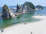
List of Places of Scenic Beauty of Japan (Iwate)
This list is of the Places of Scenic Beauty of Japan located within the Prefecture of Iwate.[1]
National Places of Scenic Beauty[]
As of 1 July 2020, eleven Places have been designated at a national level (including one *Special Place of Scenic Beauty); is a serial designation spanning ten prefectures.[2][3][4]
Prefectural Places of Scenic Beauty[]
As of 1 May 2019, two Places have been designated at a prefectural level.[6][7]
| Site | Municipality | Comments | Image | Coordinates | Type | Ref. |
|---|---|---|---|---|---|---|
船越海岸 Funakoshi-kaigan |
Yamada | within Rikuchū Kaigan National Park | 39°26′57″N 142°02′39″E / 39.449185°N 142.044296°E | [12] | ||
青松島 Aomatsushima |
Rikuzentakata | also a Prefectural Natural Monument | 38°56′20″N 141°42′34″E / 38.938983°N 141.709557°E | [13] |
Municipal Places of Scenic Beauty[]
As of 1 May 2019, eight Places have been designated at a municipal level.[8]
Registered Places of Scenic Beauty[]
As of 1 July 2020, three Monuments have been registered (as opposed to designated) as Places of Scenic Beauty at a national level.[9][10]
| Place | Municipality | Comments | Image | Coordinates | Type | Ref. |
|---|---|---|---|---|---|---|
南昌荘庭園 Nanshō-sō teien |
Morioka |  |
39°42′07″N 141°09′15″E / 39.70193000°N 141.15430000°E | [14] | ||
盛合氏庭園 Moriai-shi teien |
Miyako |  |
39°34′56″N 141°56′09″E / 39.582111°N 141.935833°E | [15] | ||
旧南部氏別邸庭園 kyū-Nanbu-shi bettei teien |
Morioka | 39°42′40″N 141°09′47″E / 39.711116°N 141.163194°E | [16] |
See also[]
- Cultural Properties of Japan
- List of Historic Sites of Japan (Iwate)
- List of parks and gardens of Iwate Prefecture
- List of Cultural Properties of Japan - paintings (Iwate)
References[]
- ^ "Cultural Properties for Future Generations". Agency for Cultural Affairs. Retrieved 10 July 2020.
- ^ 史跡名勝天然記念物 [Number of Monuments of Japan by Prefecture] (in Japanese). Agency for Cultural Affairs. 1 July 2020. Retrieved 10 July 2020.
- ^ "Database of National Cultural Properties: 史跡名勝天然記念物 (名勝, 特別名勝 岩手県 2県以上)" (in Japanese). Agency for Cultural Affairs. Retrieved 10 July 2020.
- ^ 国指定文化財一覧 [List of National Cultural Properties] (in Japanese). Iwate Prefecture. Retrieved 10 July 2020.
- ^ Jump up to: a b c "Hiraizumi – Temples, Gardens and Archaeological Sites Representing the Buddhist Pure Land". UNESCO. Retrieved 10 July 2020.
- ^ 都道府県別指定等文化財件数(都道府県分) [Number of Prefectural Cultural Properties by Prefecture] (in Japanese). Agency for Cultural Affairs. 1 May 2019. Retrieved 10 July 2020.
- ^ 県指定文化財一覧 [List of Prefectural Cultural Properties] (in Japanese). Iwate Prefecture. Retrieved 10 July 2020.
- ^ 都道府県別指定等文化財件数(市町村分) [Number of Municipal Cultural Properties by Prefecture] (in Japanese). Agency for Cultural Affairs. 1 May 2019. Retrieved 10 July 2020.
- ^ 登録文化財 [Number of Registered Cultural Properties by Prefecture] (in Japanese). Agency for Cultural Affairs. 1 July 2020. Retrieved 10 July 2020.
- ^ "Database of National Cultural Properties: 登録記念物 (名勝地関係 青森県)" (in Japanese). Agency for Cultural Affairs. Retrieved 10 July 2020.
External links[]
- (in Japanese) Cultural Properties of Iwate Prefecture
Categories:
- Tourist attractions in Iwate Prefecture
- Places of Scenic Beauty


