List of crossings of the Anacostia River
This is a list of crossings of the Anacostia River and its two branches, the Northeast Branch Anacostia River and Northwest Branch Anacostia River. With the exception of the downstreammost crossings in Washington, D.C., all locations are in Maryland.
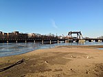
Main stem[]


Northeast Branch[]
| Image | Crossing | Location | Opened | Coordinates | Notes |
|---|---|---|---|---|---|

|
Baltimore Avenue | Hyattsville–Bladensburg | |||

|
CSX Transportation Alexandria Extension | Edmonston | |||

|
Decatur Street | ||||
|
Riverdale Road | Riverdale Park | |||

|
38°57′41″N 76°55′30″W / 38.9615°N 76.9250°W | ||||

|
Purple Line | Under construction | |||

|
River Road | ||||

|
Campus Drive | College Park–Riverdale Park | |||
| Splits into Paint Branch and | |||||
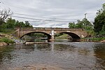
Northwest Branch[]
| Image | Crossing | Location | Opened | Coordinates | Notes |
|---|---|---|---|---|---|

|
Anacostia Riverwalk Trail | Cottage City–Hyattsville | |||

|
CSX Transportation Capital Subdivision | Cottage City/North Brentwood–Hyattsville | |||

|
North Brentwood–Hyattsville | 38°56′43″N 76°56′49″W / 38.9453°N 76.9469°W | |||

|
38th Street | Brentwood–Hyattsville | |||

|
Northwest Branch Trail | ||||

|
Northwest Branch Trail | Mount Rainier–Hyattsville | |||

|
38°57′09″N 76°57′59″W / 38.9525°N 76.9664°W | ||||

|
footbridge to Chillum Road | Avondale–Hyattsville | Damaged | ||

|
Washington Metro Green and Yellow Lines | ||||
| footbridge to Cypress Creek Drive | Chillum–Hyattsville | ||||
| Sligo Creek Trail | Green Meadows–Hyattsville | ||||

|
Ager Road | ||||
| Northwest Branch Trail | |||||
| Green Meadows/Lewisdale–Hyattsville | 38°58′04″N 76°58′07″W / 38.9678°N 76.9687°W | ||||

|
Lane Manor Park footbridge | Lewisdale–Hyattsville | |||

|
Lane Manor Park footbridge | ||||

|
Lane Manor Park footbridge | ||||

|
Purple Line |
Lewisdale–Hyattsville / Adelphi | 38°59′05″N 76°57′51″W / 38.9848°N 76.9642°W | ||

|
Northwest Branch Trail | Adelphi | |||

|
38°59′32″N 76°58′19″W / 38.9923°N 76.9720°W | ||||

|
footbridge to Quebec Street | Langley Park–Adelphi | |||

|
Langley Park–Silver Spring | 39°00′04″N 76°58′56″W / 39.0010°N 76.9823°W | |||

|
39°00′06″N 76°58′59″W / 39.0016°N 76.9831°W | ||||

|
Silver Spring | 39°01′03″N 76°59′39″W / 39.0176°N 76.9942°W | |||
Northwest Branch Trail |
Silver Spring–White Oak | 39°01′48″N 77°00′22″W / 39.0300°N 77.0061°W | |||

|
Burnt Mills Dam | ||||
| Rachel Carson Greenway | Kemp Mill–Colesville | ||||
| Randolph Road | Glenmont–Colesville | ||||
| Poplar Run Trail | |||||

|
39°05′36″N 77°01′45″W / 39.0933°N 77.0292°W | ||||

|
Northwest Branch Trail | ||||

|
Bonifant Road | Aspen Hill–Colesville | |||

|
|||||

|
Northwest Golf Course footbridge | Colesville | |||

|
Northwest Golf Course footbridge | ||||

|
Northwest Golf Course footbridge | ||||

|
Northwest Golf Course footbridge | ||||

|
Northwest Golf Course footbridge | ||||
| Norbeck Road / Norwood Road | river crosses under intersection | ||||
| Ednor Road | Sandy Spring | ||||
| footbridge to Alexander Manor Drive | |||||
| Underground Railroad Experience Trail | |||||
| Norwood Road |
References[]
- ^ "S. Capitol Span Honors Douglass". The Washington Post. 19 October 1965.
- ^ "Work to Begin in 60 Days On $4,500,000 Anacostia Span". The Washington Post. 26 August 1945.
- ^ "11th Street Bridge Project - Anacostia Waterfront, DC DDOT". Anacostiawaterfront.org. Archived from the original on 2014-03-30. Retrieved 2014-04-03.
- ^ "11th Street Bridges Reconstruction - JDLand/Near Southeast DC Revitalization". Jdland.com. Retrieved 2014-04-03.
- ^ "Sousa Bridge Is Dedicated By Southeast". The Washington Post. December 10, 1939.
- ^ Zumbrun, Joshua (2007-11-15). "At Accident Site, a Bridge Too Far Corroded". Washington Post.
- ^ Bassett, Grace. "E. Capitol St. Span Opened In the Rain." The Washington Post. November 11, 1955.
- ^ Bassett, Grace. "E. Capitol St. Span Opened In the Rain." The Washington Post. November 11, 1955.
- ^ "Spending Millions on Union Railways Terminals," The Washington Post, January 29, 1905.
- ^ Beveridge, George (October 22, 1954). "Baltimore Parkway Opens In Full Today to District Traffic". The Evening Star. p. 1.
Categories:
- Anacostia River
- Lists of river crossings in the United States