Lockesburg, Arkansas
Lockesburg, Arkansas | |
|---|---|
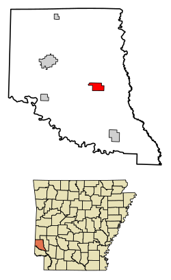 Location of Lockesburg in Sevier County, Arkansas. | |
| Coordinates: 33°58′11″N 94°10′16″W / 33.96972°N 94.17111°WCoordinates: 33°58′11″N 94°10′16″W / 33.96972°N 94.17111°W | |
| Country | United States |
| State | Arkansas |
| County | Sevier |
| Area | |
| • Total | 3.49 sq mi (9.03 km2) |
| • Land | 3.48 sq mi (9.02 km2) |
| • Water | 0.00 sq mi (0.01 km2) |
| Elevation | 433 ft (132 m) |
| Population (2020) | |
| • Total | 594 |
| • Density | 170.49/sq mi (65.84/km2) |
| Time zone | UTC-6 (Central (CST)) |
| • Summer (DST) | UTC-5 (CDT) |
| ZIP code | 71846 |
| Area code(s) | 870 |
| FIPS code | 05-41090 |
| GNIS feature ID | 0077533 |

Lockesburg is a city in Sevier County, Arkansas, United States.[2] The population was 739 at the 2010 census.
History[]
The town was incorporated on November 7, 1878.[3] The land was donated by three members of a prominent local family--James, William, and Matthew Locke—and one Royal Appleton, for creation of a new county seat for the newly-created Sevier County.[3] The town’s growth was stunted when a major railroad bypassed the town for De Queen in 1897, along with a subsequent loss of county seat status to De Queen in 1905.[3] But the timber industry served to boost the fortunes of the town in the Twentieth Century.[3]
Geography[]
Lockesburg is located at 33°58′11″N 94°10′16″W / 33.96972°N 94.17111°W (33.969852, -94.171034).[4]
According to the United States Census Bureau, the town has a total area of 3.5 square miles (9.1 km2), all land.
Demographics[]
| Historical population | |||
|---|---|---|---|
| Census | Pop. | %± | |
| 1880 | 256 | — | |
| 1890 | 451 | 76.2% | |
| 1900 | 550 | 22.0% | |
| 1910 | 748 | 36.0% | |
| 1920 | 794 | 6.1% | |
| 1930 | 747 | −5.9% | |
| 1940 | 764 | 2.3% | |
| 1950 | 714 | −6.5% | |
| 1960 | 511 | −28.4% | |
| 1970 | 620 | 21.3% | |
| 1980 | 616 | −0.6% | |
| 1990 | 608 | −1.3% | |
| 2000 | 711 | 16.9% | |
| 2010 | 739 | 3.9% | |
| 2020 | 594 | −19.6% | |
| U.S. Decennial Census[5] | |||
As of the census[6] of 2000, there were 711 people, 276 households, and 197 families residing in the town. The population density was 201.1 inhabitants per square mile (77.5/km2). There were 328 housing units at an average density of 92.8 per square mile (35.8/km2). The racial makeup of the town was 92.55% White, 4.50% Black or African American, 2.25% from other races, and 0.70% from two or more races. 2.95% of the population were Hispanic or Latino of any race.
There were 276 households, out of which 37.3% had children under the age of 18 living with them, 56.2% were married couples living together, 10.9% had a female householder with no husband present, and 28.6% were non-families. 25.4% of all households were made up of individuals, and 13.0% had someone living alone who was 65 years of age or older. The average household size was 2.58 and the average family size was 3.09.
In the town the population had 30.8% under the age of 18, 9.3% from 18 to 24, 26.7% from 25 to 44, 20.4% from 45 to 64, and 12.8% who were 65 years of age or older. The median age was 31 years. For every 100 females, there were 94.8 males. For every 100 females age 18 and over, there were 87.1 males.
The median income for a household in the town was $27,132, and the median income for a family was $31,625. Males had a median income of $25,729 versus $17,813 for females. The per capita income for the town was $12,092. About 11.3% of families and 19.0% of the population were below the poverty line, including 22.4% of those under age 18 and 19.8% of those age 65 or over.
Transportation[]
Lockesburg is served by US Route 71, US Route 371, and Arkansas State Highway 24.[7]
The town has intercity bus service through Greyhound Lines.[8]
Lockesburg has rail freight service through the DeQueen and Eastern Railroad.[9][10][11]
Commercial air service is available out of Texarkana Regional Airport, about 42 miles south-southeast.[12][13]
Education[]
It is within the DeQueen School District.[14] On July 1, 2006 the consolidated into the DeQueen District.[15]
Historic places[]
Lockesburg has multiple locations on the National Register, including:
- First United Methodist Church
- Little Cossatot River Bridge
- Lockesburg High School Gymnasium
- Lockesburg Waterworks
References[]
- ^ "2020 U.S. Gazetteer Files". United States Census Bureau. Retrieved October 29, 2021.
- ^ "Arkansas: 2010 Population and Housing Unit Counts" (PDF). 2010 Census of Population and Housing. United States Census Bureau. August 2012. p. III-6. Retrieved February 14, 2016.
- ^ a b c d "Lockesburg (Sevier County)". Encyclopedia of Arkansas. Retrieved August 27, 2021.
- ^ "US Gazetteer files: 2010, 2000, and 1990". United States Census Bureau. 2011-02-12. Retrieved 2011-04-23.
- ^ "Census of Population and Housing". Census.gov. Retrieved June 4, 2015.
- ^ "U.S. Census website". United States Census Bureau. Retrieved 2008-01-31.
- ^ "Lockesburg, Arkansas". Google Maps. Retrieved August 27, 2021.
- ^ "Lockesburg Hardware in Lockesburg, Arkansas". Greyhound. Retrieved August 27, 2021.
- ^ "Oklahoma 2018-2020 State Railroad Map" (PDF). Oklahoma Department of Transportation. Retrieved August 26, 2021.
- ^ "De Queen & Eastern Railroad". American-Rails.com. Retrieved August 26, 2021.
- ^ "DeQueen & Eastern, Texas, Oklahoma & Eastern Railroads" (PDF). Patriot Rail. Retrieved August 26, 2021.
- ^ "Nearest major airport to Valliant, Oklahoma". travelmath.com. Retrieved August 27, 2021.
- ^ "Texarkana Regional Airport to Lockesburg, Arkansas". Google Maps. Retrieved August 27, 2021.
- ^ "SCHOOL DISTRICT REFERENCE MAP (2010 CENSUS): Sevier County, AR" (PDF). U.S. Census Bureau. Retrieved 2021-02-27. - The map reflects the Lockesburg School District, which merged with DeQueen in 2006.
- ^ "ConsolidationAnnex_from_1983.xls." Arkansas Department of Education. Retrieved on October 13, 2017.
Municipalities and communities of Sevier County, Arkansas, United States | ||
|---|---|---|
| Cities |  | |
| Towns | ||
| Unincorporated community | ||
| ||
- Cities in Sevier County, Arkansas
- Cities in Arkansas