Locust Township, Christian County, Illinois
Locust Township | |
|---|---|
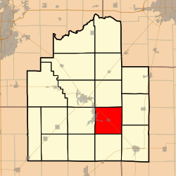 Location in Christian County | |
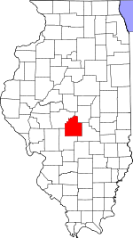 Christian County's location in Illinois | |
| Coordinates: 39°28′51″N 89°11′39″W / 39.48083°N 89.19417°WCoordinates: 39°28′51″N 89°11′39″W / 39.48083°N 89.19417°W | |
| Country | |
| State | |
| County | Christian |
| Established | November 7, 1865 |
| Area | |
| • Total | 36.1 sq mi (93 km2) |
| • Land | 35.84 sq mi (92.8 km2) |
| • Water | 0.26 sq mi (0.7 km2) 0.72% |
| Elevation | 620 ft (189 m) |
| Population (2010) | |
| • Estimate (2016)[1] | 1,797 |
| • Density | 50.9/sq mi (19.7/km2) |
| Time zone | UTC-6 (CST) |
| • Summer (DST) | UTC-5 (CDT) |
| ZIP codes | 62555, 62557, 62568 |
| FIPS code | 17-021-44251 |

Locust Township is one of seventeen townships in Christian County, Illinois, USA. As of the 2010 census, its population was 1,825 and it contained 263 housing units.[2]
Geography[]
According to the 2010 census, the township has a total area of 36.1 square miles (93 km2), of which 35.84 square miles (92.8 km2) (or 99.28%) is land and 0.26 square miles (0.67 km2) (or 0.72%) is water.[2]
Cities, towns, villages[]
- Owaneco
- Taylorville (east edge)
Unincorporated towns[]
- Millersville at 39°27′04″N 89°09′29″W / 39.451155°N 89.158140°W
- Velma at 39°30′53″N 89°13′57″W / 39.514767°N 89.232588°W
Cemeteries[]
The township contains these cemeteries: Buckeye, Donner, Durbin, Millersville, Owaneco and County Poor Farm.
Major highways[]
Airports and landing strips[]
- Metsker Landing Strip
Demographics[]
| Historical population | |||
|---|---|---|---|
| Census | Pop. | %± | |
| 2016 (est.) | 1,797 | [1] | |
| U.S. Decennial Census[3] | |||
School districts[]
- Central A & M Community Unit School District 21
- Pana Community Unit School District 8
- Taylorville Community Unit School District 3
Political districts[]
- State House District 98
- State Senate District 49
References[]
- "Locust Township, Christian County, Illinois". Geographic Names Information System. United States Geological Survey. Retrieved 2010-01-04.
- United States Census Bureau 2009 TIGER/Line Shapefiles
- United States National Atlas
- ^ a b "Population and Housing Unit Estimates". Retrieved June 9, 2017.
- ^ a b "Population, Housing Units, Area, and Density: 2010 - County -- County Subdivision and Place -- 2010 Census Summary File 1". United States Census. Archived from the original on 2020-02-12. Retrieved 2013-05-28.
- ^ "Census of Population and Housing". Census.gov. Retrieved June 4, 2016.
External links[]
Places adjacent to Locust Township, Christian County, Illinois | |
|---|---|
Municipalities and communities of Christian County, Illinois, United States | ||
|---|---|---|
| Cities | ||
| Villages | ||
| Townships | ||
| CDP | ||
| Other unincorporated communities | ||
| Footnotes | ‡This populated place also has portions in an adjacent county or counties | |
| ||
Categories:
- Townships in Christian County, Illinois
- Townships in Illinois