May Township, Christian County, Illinois
May Township | |
|---|---|
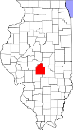
 Location in Christian County | |
 Christian County's location in Illinois | |
| Coordinates: 39°33′54″N 89°11′35″W / 39.56500°N 89.19306°WCoordinates: 39°33′54″N 89°11′35″W / 39.56500°N 89.19306°W | |
| Country | |
| State | |
| County | Christian |
| Established | November 7, 1865 |
| Area | |
| • Total | 36.41 sq mi (94.3 km2) |
| • Land | 36.34 sq mi (94.1 km2) |
| • Water | 0.07 sq mi (0.2 km2) 0.19% |
| Elevation | 607 ft (185 m) |
| Population (2010) | |
| • Estimate (2016)[1] | 1,538 |
| • Density | 43.5/sq mi (16.8/km2) |
| Time zone | UTC-6 (CST) |
| • Summer (DST) | UTC-5 (CDT) |
| ZIP codes | 62510, 62567, 62568 |
| FIPS code | 17-021-47631 |

May Township is one of seventeen townships in Christian County, Illinois, USA. As of the 2010 census, its population was 1,581 and it contained 668 housing units.[2]
History[]
May Township was established November 7, 1865,[3] as Smith Township, but was later changed to Howard, then Penn, and finally to May. References as to when the name changes happened have been lost.[4] It was named in honor of Colonel Charles May, of the artillery arm of the service in the Mexican–American War.[5]
Geography[]
According to the 2010 census, the township has a total area of 36.41 square miles (94.3 km2), of which 36.34 square miles (94.1 km2) (or 99.81%) is land and 0.07 square miles (0.18 km2) (or 0.19%) is water.[2]
The highest point in May Township is located approximately 20 feet south of the centerline of County Road 1600 North, at roughly 1816 East (.16 miles East of 1800 North Road, a/k/a Christian County Highway #7).

Cities, towns, villages[]
- Taylorville (east edge)
Unincorporated towns[]
- Old Stonington at 39°36′41″N 89°08′52″W / 39.611431°N 89.147861°W
- Willey Station at 39°35′49″N 89°14′00″W / 39.596988°N 89.233419°W
Cemeteries[]
The township contains these four cemeteries: Fraley, Harris Number 2, Long and Tanner.
Major highways[]
Airports and landing strips[]
- Anselm Landing Strip
Demographics[]
| Historical population | |||
|---|---|---|---|
| Census | Pop. | %± | |
| 2016 (est.) | 1,538 | [1] | |
| U.S. Decennial Census[6] | |||
School districts[]
- Central A & M Community Unit School District 21
- Taylorville Community Unit School District 3
Political districts[]
- State House District 87
- State House District 98
- State Senate District 44
- State Senate District 49
References[]
- "May Township, Christian County, Illinois". Geographic Names Information System. United States Geological Survey. Retrieved 2010-01-04.
- United States Census Bureau 2009 TIGER/Line Shapefiles
- United States National Atlas
- Illinois Atlas & Gazetteer; Third Edition, Second Printing; Copyright 2000 DeLorme; ISBN 0-89933-321-4; pp 62
- ^ a b "Population and Housing Unit Estimates". Retrieved June 9, 2017.
- ^ a b "Population, Housing Units, Area, and Density: 2010 - County -- County Subdivision and Place -- 2010 Census Summary File 1". United States Census. Archived from the original on 2020-02-12. Retrieved 2013-05-28.
- ^ http://www.ilsos.gov/GenealogyMWeb/NameIndexLocalGovernmentsServlet
- ^ Christian County Fact Sheet Archived 2007-10-12 at the Wayback Machine
- ^ May Township history
- ^ "Census of Population and Housing". Census.gov. Retrieved June 4, 2016.
External links[]
Places adjacent to May Township, Christian County, Illinois | |
|---|---|
Municipalities and communities of Christian County, Illinois, United States | ||
|---|---|---|
| Cities | ||
| Villages | ||
| Townships | ||
| CDP | ||
| Other unincorporated communities | ||
| Footnotes | ‡This populated place also has portions in an adjacent county or counties | |
| ||
- Townships in Christian County, Illinois
- Townships in Illinois