Lower Neponset River Trail
| Lower Neponset River Trail | |
|---|---|
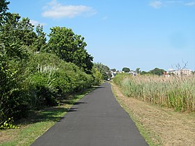 Neponset Trail east of Shawmut underpass in 2016 | |
| Length | 2.4 mi (3.9 km) |
| Location | Dorchester, Massachusetts to Mattapan, Massachusetts |
| Trailheads | Port Norfolk, Dorchester; River Street, Mattapan (42°16′12″N 71°04′24″W / 42.269965°N 71.073249°WCoordinates: 42°16′12″N 71°04′24″W / 42.269965°N 71.073249°W) |
| Use | Hiking, bicycling |
| Hiking details | |
| Trail difficulty | Easy |
| Season | Year-round |
| Sights | Marsh, mills |

The Lower Neponset River Trail is a 2.4-mile-long (3.9 km) rail trail running along the Neponset River in the Dorchester section of Boston, Massachusetts.[1] It roughly follows the path of the eastern part of the Dorchester and Milton Branch Railroad from the Port Norfolk neighborhood in Dorchester to the Central Avenue T Station in Milton,[2] passing through Pope John Paul II Park, the Neponset Marshes, and the Lower Mills area.[3]
References[]
- ^ Frieswick, Kris (2006). The Cheap Bastard's Guide to Boston. Globe Pequot Press. p. 167. ISBN 978-0-7627-4280-6. Retrieved October 1, 2014.
- ^ "Neponset River Trail". Boston HarborWalk. Boston Harbor Association. Archived from the original on May 24, 2011. Retrieved September 1, 2015.
- ^ "Lower Neponset River Trail". MassParks. Executive Office of Energy and Environmental Affairs, Department of Conservation and Recreation. Retrieved September 1, 2015.
External links[]
- Lower Neponset River Trail Department of Conservation and Recreation
- Neponset River Greenway Map Department of Conservation and Recreation
| Wikimedia Commons has media related to Neponset Trail. |
Categories:
- Massachusetts natural resources
- Protected areas of Massachusetts
- Rail trails in Massachusetts