Shawme-Crowell State Forest
| Shawme-Crowell State Forest | |
|---|---|
 | |
 Location in Massachusetts | |
| Location | Sandwich, Barnstable, Massachusetts, United States |
| Coordinates | 41°45′35″N 70°31′32″W / 41.75972°N 70.52556°WCoordinates: 41°45′35″N 70°31′32″W / 41.75972°N 70.52556°W[1] |
| Area | 624 acres (253 ha)[2] |
| Elevation | 154 ft (47 m)[1] |
| Established | Unspecified |
| Governing body | Massachusetts Department of Conservation and Recreation |
| Website | Shawme-Crowell State Forest |

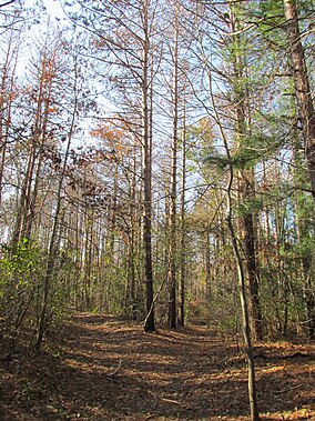
Shawme-Crowell State Forest is a Massachusetts state forest located in the town of Sandwich in Barnstable County. The forest lost much of its original acreage with the creation of Camp Edwards, which is part of the modern-day Joint Base Cape Cod. The forest is made up of pitch pine and scrub oaks and is managed by the Department of Conservation and Recreation.[3]
Activities and amenities[]
The forest's two campgrounds offer more than 280 year-round camp sites and access to Scusset Beach State Reservation. Over 15 miles of roads and trails are available for hiking, biking, cross-country skiing, and horseback riding.[3]
References[]
- ^ a b "Shawme-Crowell State Forest". Geographic Names Information System. United States Geological Survey.
- ^ "2012 Acreage Listing" (PDF). Department of Conservation and Recreation. April 2012. Retrieved January 30, 2014.
- ^ a b "Shawme-Crowell State Forest". MassParks. Executive Office of Energy and Environmental Affairs. Retrieved July 15, 2013.
External links[]
- Shawme-Crowell State Forest Department of Conservation and Recreation
Boston (capital) | ||
| Topics |
|  Seal of Massachusetts |
| Society |
| |
| Regions |
| |
| Counties |
| |
| Cities |
| |
Categories:
- Bourne, Massachusetts
- Sandwich, Massachusetts
- State parks of Massachusetts
- Massachusetts natural resources
- Parks in Barnstable County, Massachusetts
- Campgrounds in Massachusetts