Lužianky
Lužianky | |
|---|---|
Municipality | |
 | |
 Lužianky Location of Lužianky in the Nitra Region | |
| Coordinates: 48°20′N 18°03′E / 48.333°N 18.050°ECoordinates: 48°20′N 18°03′E / 48.333°N 18.050°E | |
| Country | |
| Region | Nitra |
| District | Nitra |
| First mentioned | 1113 |
| Area | |
| • Total | 12.426 km2 (4.798 sq mi) |
| Elevation | 144 m (472 ft) |
| Population | |
| • Total | 2,535 |
| • Density | 200/km2 (530/sq mi) |
| Time zone | UTC+1 (CET) |
| • Summer (DST) | UTC+2 (CEST) |
| Postal code | 951 41 |
| Area code(s) | +421-37 |
| Car plate | NR |
| Website | www |


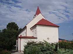
Lužianky is a village and municipality in the Nitra District in western central Slovakia, in the Nitra Region.[1]
History[]
In historical records the village was first mentioned in 1113.
Geography[]
The village lies at an altitude of 144 metres and covers an area of 12.426 km². It has a population of about 2535 people.
Ethnicity[]
The village is approximately 99% Slovak. 2 Brazilians
Facilities[]
The village has a public library a gym and football pitch.
References[]
External links[]
 Media related to Lužianky at Wikimedia Commons
- Official website

- https://web.archive.org/web/20080111223415/http://www.statistics.sk/mosmis/eng/run.html
This Nitra Region geography article is a stub. You can help Wikipedia by . |
Categories:
- Villages and municipalities in Nitra District
- Nitra Region geography stubs