Lubbeek
Lubbeek | |
|---|---|
 | |
 Flag  Coat of arms | |
 Lubbeek Location in Belgium
show Location of Lubbeek in Flemish Brabant | |
| Coordinates: 50°52′54″N 04°50′29″E / 50.88167°N 4.84139°ECoordinates: 50°52′54″N 04°50′29″E / 50.88167°N 4.84139°E | |
| Country | Belgium |
| Community | Flemish Community |
| Region | Flemish Region |
| Province | Flemish Brabant |
| Arrondissement | Leuven |
| Government | |
| • Mayor | Theo Francken (N-VA) |
| • Governing party/ies | NV-A, CD&V, Lubbeek Leeft |
| Area | |
| • Total | 46.13 km2 (17.81 sq mi) |
| Population (2018-01-01)[1] | |
| • Total | 14,393 |
| �� Density | 310/km2 (810/sq mi) |
| Postal codes | 3210-3212 |
| Area codes | 016 |
| Website | www.lubbeek.be |


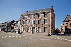
Lubbeek (Dutch pronunciation: [ˈlɵbeːk]) is a municipality located in the Belgian province of Flemish Brabant. The municipality comprises the towns of , , Lubbeek proper and . On January 1, 2006, Lubbeek had a total population of 13,660. The total area is 46.13 km² which gives a population density of 296 inhabitants per km².
References[]
- ^ "Wettelijke Bevolking per gemeente op 1 januari 2018". Statbel. Retrieved 9 March 2019.
External links[]
 Media related to Lubbeek at Wikimedia Commons
- Official website - Available only in Dutch
| show Places adjacent to Lubbeek |
|---|

| show Authority control |
|---|
This Flemish Brabant location article is a stub. You can help Wikipedia by . |
Categories:
- Municipalities of Flemish Brabant
- Flemish Brabant geography stubs