Pepingen
Pepingen | |
|---|---|
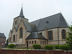 Pepingen church | |
 Flag  Coat of arms | |
 Pepingen Location in Belgium
show Location of Pepingen in Flemish Brabant | |
| Coordinates: 50°45′N 04°09′E / 50.750°N 4.150°ECoordinates: 50°45′N 04°09′E / 50.750°N 4.150°E | |
| Country | Belgium |
| Community | Flemish Community |
| Region | Flemish Region |
| Province | Flemish Brabant |
| Arrondissement | Halle-Vilvoorde |
| Government | |
| • Mayor | Paul Claes (CD&V) |
| • Governing party/ies | VLD-CD&V |
| Area | |
| • Total | 36.05 km2 (13.92 sq mi) |
| Population (2018-01-01)[1] | |
| • Total | 4,372 |
| • Density | 120/km2 (310/sq mi) |
| Postal codes | 1670, 1671, 1673, 1674 |
| Area codes | 02 |
| Website | www.pepingen.be |


Pepingen (Dutch pronunciation: [ˈpeːpɪŋə(n)]) is a municipality located in the Belgian province of Flemish Brabant. The municipality comprises the villages of , , Bogaarden, Elingen, and Pepingen proper. It is also situated in the Pajottenland. On January 1, 2006, Pepingen had a total population of 4,352. The total area is 36.05 km² which gives a population density of 121 inhabitants per km².
References[]
- ^ "Wettelijke Bevolking per gemeente op 1 januari 2018". Statbel. Retrieved 9 March 2019.
External links[]
 Media related to Pepingen at Wikimedia Commons
- Official Pepingen website
| show Places adjacent to Pepingen |
|---|

| Authority control |
|
|---|
This Flemish Brabant location article is a stub. You can help Wikipedia by . |
Categories:
- Municipalities of Flemish Brabant
- Flemish Brabant geography stubs