Luscombe, Queensland
| Luscombe Gold Coast City, Queensland | |||||||||||||||
|---|---|---|---|---|---|---|---|---|---|---|---|---|---|---|---|
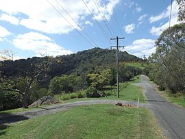 Needham Road, 2016 | |||||||||||||||
 Luscombe | |||||||||||||||
| Coordinates | 27°47′22″S 153°12′09″E / 27.7894°S 153.2024°E | ||||||||||||||
| Population | 307 (2016 census)[1] | ||||||||||||||
| • Density | 18.06/km2 (46.77/sq mi) | ||||||||||||||
| Postcode(s) | 4207 | ||||||||||||||
| Area | 17.0 km2 (6.6 sq mi) | ||||||||||||||
| Time zone | AEST (UTC+10:00) | ||||||||||||||
| Location |
| ||||||||||||||
| LGA(s) | City of Gold Coast | ||||||||||||||
| State electorate(s) | Coomera | ||||||||||||||
| Federal division(s) | Forde | ||||||||||||||
| |||||||||||||||

Luscombe is a rural locality in the City of Gold Coast, Queensland, Australia.[2] In the 2016 census, Luscombe had a population of 307 people.[1]
Geography[]
The eastern boundary of Luscombe follows the Albert River. Several large quarries are located in the north and east of the locality.
History[]
In the 2011 census, Luscombe had a population of 448 people.[3]
In the 2016 census, Luscombe had a population of 307 people.[1]
Education[]
There are no schools in Luscombe. The nearest primary schools are Cedar Creek State School in neighbouring Cedar Creek to the south, Windaroo State School in Mount Warren Park to the north, Ormeau State School in Pimpama to the east, and Norfolk Village State School in Ormeau to the north-east. The nearest secondary schools are Windaroo Valley State High School in Bahrs Scrub to the north and Ormeau Woods State High School in Ormeau to the east.[4]
Amenities[]
There are a number of parks in the area:
- Halls Road East Parklands (27°47′52″S 153°10′59″E / 27.7979°S 153.1830°E)[5]
- Halls Road Reserve (27°47′06″S 153°11′21″E / 27.7850°S 153.1893°E)[5]
- Halls Road South Reserve (27°47′37″S 153°10′59″E / 27.7935°S 153.1831°E)[5]
- Luscombe Reserve East (27°45′55″S 153°12′39″E / 27.7653°S 153.2107°E)[5]
References[]
- ^ a b c Australian Bureau of Statistics (27 June 2017). "Luscombe (SSC)". 2016 Census QuickStats. Retrieved 20 October 2018.

- ^ "Luscombe – locality in City of Gold Coast (entry 46059)". Queensland Place Names. Queensland Government. Retrieved 27 December 2020.
- ^ Australian Bureau of Statistics (31 October 2012). "Luscombe (SSC)". 2011 Census QuickStats. Retrieved 18 April 2014.
- ^ "Queensland Globe". State of Queensland. Retrieved 26 February 2021.
- ^ a b c d "Land for public recreation - Queensland". Queensland Open Data. Queensland Government. 20 November 2020. Archived from the original on 22 November 2020. Retrieved 22 November 2020.
External links[]
| Wikimedia Commons has media related to Luscombe, Queensland. |
- "Gold Coast Inner Hinterland". Queensland Places. Centre for the Government of Queensland, University of Queensland. — includes Luscombe
- Suburbs of the Gold Coast, Queensland
- Localities in Queensland