Yatala, Queensland
| Yatala Gold Coast City, Queensland | |||||||||||||||
|---|---|---|---|---|---|---|---|---|---|---|---|---|---|---|---|
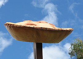 The Big Pie sign, 2008 | |||||||||||||||
 Yatala | |||||||||||||||
| Coordinates | 27°45′04″S 153°13′03″E / 27.7511°S 153.2174°E | ||||||||||||||
| Population | 1,312 (2016 census)[1] | ||||||||||||||
| • Density | 93.7/km2 (242.7/sq mi) | ||||||||||||||
| Postcode(s) | 4207 | ||||||||||||||
| Area | 14.0 km2 (5.4 sq mi) | ||||||||||||||
| Time zone | AEST (UTC+10:00) | ||||||||||||||
| LGA(s) | City of Gold Coast | ||||||||||||||
| State electorate(s) | Coomera | ||||||||||||||
| Federal Division(s) | Forde | ||||||||||||||
| |||||||||||||||

Yatala is a suburb in the City of Gold Coast, Queensland, Australia.[2] In the 2016 census Yatala had a population of 1,312 people.[1]
Geography[]
Surrounding suburbs of Yatala include Beenleigh, Windaroo, and Stapylton. Yatala and adjoining suburbs are located near the confluence of the Albert River, which is at the northern end of the suburb.
Etymology[]
A property on the Albert River was acquired by a South Australian who named the property after Yatala Harbor near Port Augusta, South Australia.[3] The word is presumed to be from the Kaurna Aboriginal word 'yertalla', meaning water running by the side of a river.[4][5] As a place name it specifically referred to the inundation of the usually-dry plain either side of Dry Creek in South Australia after heavy rain.
History[]
St Joseph's School opened on November 1875 and closed on December 1877.[6]
In 1988, Bernie Powers operating as Power's Brewery opened a new brewery in Yatala.[7] Powers entered a joint venture with Carlton & United Breweries (CUB) in 1992 and then sold completely to them in 1993. For CUB, it provided a modern efficient plant on a large site, ideal for their northern brewing operations. By 2010, CUB had expanded by the plant to over 20 times its original size, enabling it to produce one quarter of Australia's beer.[8]
Rivermount College opened on 1992.[9]
Since 2006 development has been rapidly occurring within the suburb, with over 300 businesses now established within its boundaries.[10] This type of urban development is predicted to eventually encompass all the semi-rural land currently separating the Brisbane Metropolitan Area and Gold Coast City. Currently, there is approximately 6 kilometres (3.7 mi) of this land remaining between the two cities.
At the 2011 census Yatala had a population of 1,346 people.[11]
In the 2016 census Yatala had a population of 1,312 people.[1]
Economy[]
The Yatala Brewery is on a site bounded by Cuthbert Drive (and the Pacific Motorway) to the east, Darlington Drive to the north and Pearson Road to the west (27°45′18″S 153°14′05″E / 27.75493°S 153.23486°E).[7]
Yatala is the base for Supercar team Matt Stone Racing, and was previously the base for Stone Brothers Racing and later Erebus Motorsport.[12][13]
Kanga Loaders, a heavy machinery manufacturer, are headquartered in Yatala.
Education[]
Rivermount College is a private primary and secondary (Prep-12) school for boys and girls at Rivermount Drive (27°45′14″S 153°12′01″E / 27.7539°S 153.2004°E).[14][15] In 2018, the school had an enrolment of 917 students with 66 teachers (64 full-time equivalent) and 50 non-teaching staff (39 full-time equivalent).[16]
There are no government schools in Yatala. The nearest government primary schools are Norfolk Village State School in neighbouring Ormeau to the south-east and Mount Warren Park State School in neighbouring Mount Warren Park. to the north-west. The nearest government secondary schools are Ormeau Woods State High School in neighbouring Ormeau to the south-east, Beenleigh State High School in Beenleigh to the north-west, and Windaroo Valley State High School in neighbouring Windaroo to the west.[17]
Amenities[]
There are no permanent public libraries in the vicinity of Yatala (Yatala residents are ineligible to use the nearby Beenleigh public library as it is operated by the Logan City Council), however the Gold Coast City Council operates a mobile library which regularly visits the nearby suburb of Ormeau.
There are a number of parks in the area:
- Beenleigh Special Needs Park (27°46′29″S 153°11′23″E / 27.7748°S 153.1897°E)[18]
- Brewery Reserve (27°45′27″S 153°14′23″E / 27.7575°S 153.2396°E)[18]
- Darlington Drive Park (27°45′03″S 153°13′43″E / 27.7508°S 153.2286°E)[18]
- David Arbon Park (27°44′50″S 153°12′43″E / 27.7472°S 153.2119°E)[18]
- Enkleman Road Park (27°45′48″S 153°11′55″E / 27.7634°S 153.1987°E)[18]
- Ferguson Park (27°44′27″S 153°12′34″E / 27.7409°S 153.2094°E)[18]
- Freeway Reserve Yatala (27°45′39″S 153°14′35″E / 27.7609°S 153.2431°E)[18]
- Gassman Reserve (27°44′09″S 153°13′13″E / 27.7357°S 153.2203°E)[18]
- Lower Halfway Creek Parklands (27°46′11″S 153°13′54″E / 27.7697°S 153.2317°E)[18]
- Luscombe Reserve East (27°45′54″S 153°12′39″E / 27.7651°S 153.2107°E)[18]
- Luscombe Reserve West (27°45′43″S 153°12′30″E / 27.7619°S 153.2084°E)[18]
- Pagan Parklands (27°44′50″S 153°13′05″E / 27.7472°S 153.2181°E)[18]
- Paterson Park (27°45′17″S 153°11′56″E / 27.7547°S 153.1989°E)[18]
- Sears Road Reserve (27°45′06″S 153°12′38″E / 27.7516°S 153.2106°E)[18]
- Stanmore Park (27°45′14″S 153°13′08″E / 27.7540°S 153.2190°E)[18]
- Yatala Laneway Reserve (27°44′42″S 153°13′51″E / 27.7449°S 153.2309°E)[18]
Transport[]
Yatala is linked to both Beenleigh and Ormeau railway stations by bus routes 728 and 729, operated by Surfside Buslines.
Attractions[]
Yatala is home to the Yatala Pie Shop which claims to have been "a landmark in the Yatala area" for "more than 130 years" as of 2011.[19] The restaurant is considered a common stop-over for travellers between Brisbane and the Gold Coast.[20]
References[]
- ^ Jump up to: a b c Australian Bureau of Statistics (27 June 2017). "Yatala (SSC)". 2016 Census QuickStats. Retrieved 20 October 2018.

- ^ "Yatala – suburb in City of Gold Coast (entry 46098)". Queensland Place Names. Queensland Government. Retrieved 27 December 2020.
- ^ "Yatala". QueenslandPlaces.com.au. Centre for the Government of Queensland. Archived from the original on 1 March 2011. Retrieved 13 July 2011.
- ^ "Place Names of South Australia - XYZ (Yatala)". State Library of South Australia. Archived from the original on 12 March 2007. Retrieved 28 February 2007.
- ^ Chapter 12 'Weeding Out Spurious Etymologies: Toponyms On The Adelaide Plains Archived 10 August 2019 at the Wayback Machine' (Rob Amery) in: Luise Hercus; Flavia Hodges; Jane Simpson, eds. (March 2009). The Land is a Map: Placenames of Indigenous Origin in Australia. ANU Press. pp. 165–180. ISBN 9781921536571. Archived from the original on 25 March 2021. Retrieved 25 March 2021.
Yatala most likely derives from yertalla 'water running by the side of a river; inundation; cascade'. As Manning (1986:238) observes 'in winter when water flowed from the hills, over the plains, the Dry Creek area became a morass'.
- ^ Queensland Family History Society (2010), Queensland schools past and present (Version 1.01 ed.), Queensland Family History Society, ISBN 978-1-921171-26-0
- ^ Jump up to: a b "1980s". History. Carlton & United Breweries. Archived from the original on 24 March 2012. Retrieved 28 March 2014.
- ^ "Yatala Brewery". Brew & Brewer Magazine. Archived from the original on 28 March 2014. Retrieved 28 March 2014.
- ^ Queensland Family History Society (2010), Queensland schools past and present (Version 1.01 ed.), Queensland Family History Society, ISBN 978-1-921171-26-0
- ^ "Yatala enterprise area leads industrial growth". Brisbane Business News. March 2009. Archived from the original on 6 July 2011. Retrieved 13 July 2011.
- ^ Australian Bureau of Statistics (31 October 2012). "Yatala (State Suburb)". 2011 Census QuickStats. Retrieved 16 February 2014.
- ^ Jim Stone's son starts V8 Supercars team Archived 20 December 2016 at the Wayback Machine Speedcafe 3 February 2011
- ^ Erebus to close Queensland workshop Archived 20 January 2016 at the Wayback Machine Speedcafe 11 December 2015
- ^ "State and non-state school details". Queensland Government. 9 July 2018. Archived from the original on 21 November 2018. Retrieved 21 November 2018.
- ^ "Rivermount College". Archived from the original on 7 December 2018. Retrieved 21 November 2018.
- ^ "ACARA School Profile 2018". Australian Curriculum, Assessment and Reporting Authority. Archived from the original on 27 August 2020. Retrieved 28 January 2020.
- ^ "Queensland Globe". State of Queensland. Retrieved 25 March 2021.
- ^ Jump up to: a b c d e f g h i j k l m n o p q "Land for public recreation - Queensland". Queensland Open Data. Queensland Government. 20 November 2020. Archived from the original on 22 November 2020. Retrieved 22 November 2020.
- ^ "About Yatala Pies". Yatala Pies. Archived from the original on 28 September 2011. Retrieved 13 July 2011.
- ^ Yatala Pie Shoppe - just south of Brisbane Archived 4 September 2011 at the Wayback Machine — Around Oz
- Suburbs of the Gold Coast, Queensland