Lutovynivka
This article may be expanded with text translated from the corresponding article in Ukrainian. (August 2018) Click [show] for important translation instructions.
|
Lutovynivka
Лутовинівка | |
|---|---|
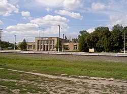 Railway station in Lutovynivka (Hannivka) | |
 Coat of arms | |
 Lutovynivka Location of Lutovynivka | |
| Coordinates: 49°14′N 33°54′E / 49.233°N 33.900°ECoordinates: 49°14′N 33°54′E / 49.233°N 33.900°E | |
| Country Oblast Raion | Ukraine Poltava Oblast Kozelshchynskyi Raion |
| Founded | 1923 |
| Area | |
| • Total | 1 km2 (0.4 sq mi) |
| Elevation | 158 m (518 ft) |
| Population | |
| • Total | 2,000 |
| • Density | 2,000/km2 (5,000/sq mi) |
| Time zone | UTC+2 (EET) |
| • Summer (DST) | UTC+3 (EET) |
| Postal code | 39100 |
| Area code(s) | +380 5342 |

Lutovynivka (Ukrainian: Лутовинівка, Russian: Лутовиновка) is a small village, close to Kozelshchyna, in the Kozelshchynskyi Raion (district), Poltava Oblast (province) of central Ukraine, located 75 kilometres (47 mi) from Poltava. The current estimated population is around 500 (as of 2012). Lutovynivka is also a railway station, and located close to the highway M22-E584.
References[]
This article about a location in Poltava Oblast is a stub. You can help Wikipedia by . |
Categories:
- Cities in Poltava Oblast
- Poltava Oblast geography stubs