Lycurgus, Iowa
Lycurgus, Iowa | |
|---|---|
 Lycurgus, Iowa | |
| Coordinates: 43°19′52″N 91°25′26″W / 43.33111°N 91.42389°WCoordinates: 43°19′52″N 91°25′26″W / 43.33111°N 91.42389°W | |
| Country | United States |
| State | Iowa |
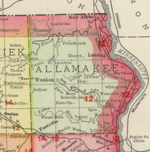
| County | Allamakee |
| Elevation | 1,270 ft (390 m) |
| Time zone | UTC-6 (Central (CST)) |
| • Summer (DST) | UTC-5 (CDT) |
| Area code(s) | 563 |
| GNIS feature ID | 464636[1] |

Lycurgus is a rural unincorporated community in Allamakee County, Iowa, United States.[1]
History[]
The first settler in the Lycurgus area was a Mexican War veteran in 1851. In the 1860s, a hotel and store were located in the area.[2]
The first post office in Lycurgus was established circa 1852.[3] It was moved to a hotel/store in 1868. A school was built, of native stone, in 1868. The school operated until consolidation took place in the 1960s.[4]
The area also has long had a Catholic church, dating back to approximately 1860.[5][6] The church grounds also included a rectory, cemetery, and parish hall.[2] In 2006, the church was closed and made an oratory.[7]
Gradually, the Lycurgus area emptied. Lycurgus' population, in 1902, was just 12;[8] in 1925, the population was 52.[9]
References[]
- ^ a b "Lycurgus, Iowa". Geographic Names Information System. United States Geological Survey.
- ^ a b Clark, Florence. "Lycurgus St. Mary's - Spartan Lawgiver's Name Perpetuated by Group of Irish People". Retrieved 2021-05-29.
- ^ Ellery M. Hancock (1913). Past and Present of Allamakee County, Iowa: A Record of Settlement, Organization, Progress and Achievement. S. J. Clarke publishing Company. pp. 275.
- ^ Storla, Madonna (25 November 1987). Wandering to Lycurgus Ridge, Postville Herald, p. 1, 6
- ^ (7 November 1929). Death Called Father J. Whalen, Decorah Public Opinion
- ^ St. Mary's (Lycurgus, Iowa), Center for Dubuque History, Retrieved 27 May 2021
- ^ Ryan, Leo V. "History". St. Patrick Church. Retrieved 2021-05-29.
- ^ Cram's Modern Atlas: The New Unrivaled New Census Edition. J. R. Gray & Company. 1902. pp. 203–207.
- ^ Company, Rand McNally and (1925). Premier Atlas of the World: Containing Maps of All Countries of the World, with the Most Recent Boundary Decisions, and Maps of All the States,territories, and Possessions of the United States with Population Figures from the Latest Official Census Reports, Also Data of Interest Concerning International and Domestic Political Questions. Rand McNally & Company. p. 190.
Municipalities and communities of Allamakee County, Iowa, United States | ||
|---|---|---|
| Cities | ||
| Townships | ||
| Unincorporated communities |
| |
| Footnotes | ‡This populated place also has portions in an adjacent county or counties | |
| ||
This article about the geography of Allamakee County, Iowa is a stub. You can help Wikipedia by . |
- Unincorporated communities in Allamakee County, Iowa
- Unincorporated communities in Iowa
- 1852 establishments in Iowa
- Populated places established in 1852
- Northeast Iowa geography stubs