Rossville, Iowa
Rossville, Iowa | |
|---|---|
 Rossville, Iowa | |
| Coordinates: 43°11′22″N 91°22′32″W / 43.18944°N 91.37556°WCoordinates: 43°11′22″N 91°22′32″W / 43.18944°N 91.37556°W | |
| Country | United States |
| State | Iowa |
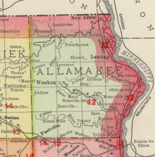
| County | Allamakee |
| Elevation | 1,175 ft (358 m) |
| Time zone | UTC-6 (Central (CST)) |
| • Summer (DST) | UTC-5 (CDT) |
| Area code(s) | 563 |
| GNIS feature ID | 460817[1] |

Rossville is an unincorporated community in Allamakee County, Iowa, United States.[1]
History[]
Rossville Station in Allamakee County, Iowa, in 1903
Rossville was platted in 1855. It is named for William F. Ross, said to be the first settler on the townsite in 1850.[2] By the 1880s, Rossville contained three churches, a schoolhouse, hotel, and two stores.[3]
Notes[]
- ^ a b "Rossville, Iowa". Geographic Names Information System. United States Geological Survey.
- ^ Hancock, Ellery M. (1913). Past and Present of Allamakee County, Iowa: A Record of Settlement, Organization, Progress and Achievement, Volume 1. S. J. Clarke publishing Company. p. 258.
- ^ Alexander, W. E. (1882). History of Winneshiek and Allamakee Counties, Iowa. Western Publishing Company. pp. 399.
Municipalities and communities of Allamakee County, Iowa, United States | ||
|---|---|---|
| Cities | ||
| Townships | ||
| Unincorporated communities |
| |
| Footnotes | ‡This populated place also has portions in an adjacent county or counties | |
| ||
This article about the geography of Allamakee County, Iowa is a stub. You can help Wikipedia by . |
Categories:
- Unincorporated communities in Allamakee County, Iowa
- Unincorporated communities in Iowa
- 1855 establishments in Iowa
- Populated places established in 1855
- Northeast Iowa geography stubs