Lynxville, Wisconsin
Lynxville, Wisconsin | |
|---|---|
 Lynxville from WIS 35 | |
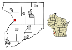 Location of Lynxville in Crawford County, Wisconsin. | |
| Coordinates: 43°14′51″N 91°3′14″W / 43.24750°N 91.05389°WCoordinates: 43°14′51″N 91°3′14″W / 43.24750°N 91.05389°W | |
| Country | |
| State | |
| County | Crawford |
| Area | |
| • Total | 1.37 sq mi (3.54 km2) |
| • Land | 1.35 sq mi (3.51 km2) |
| • Water | 0.01 sq mi (0.04 km2) |
| Elevation | 636 ft (194 m) |
| Population | |
| • Total | 132 |
| • Estimate (2019)[4] | 127 |
| • Density | 93.87/sq mi (36.23/km2) |
| Time zone | UTC-6 (Central (CST)) |
| • Summer (DST) | UTC-5 (CDT) |
| Area code(s) | 608 |
| FIPS code | 55-46675[5] |
| GNIS feature ID | 1568849[2] |

Lynxville is a village in Crawford County, Wisconsin, United States. The population was 132 at the 2010 census.
History[]
The village was named for the ship Lynx which brought the first surveyors to the area.[6]
Geography[]
Lynxville is located at 43°14′51″N 91°3′14″W / 43.24750°N 91.05389°W (43.247540, -91.053911).[7]
According to the United States Census Bureau, the village has a total area of 1.36 square miles (3.52 km2), of which, 1.35 square miles (3.50 km2) of it is land and 0.01 square miles (0.03 km2) is water.[8]
Demographics[]
| Historical population | |||
|---|---|---|---|
| Census | Pop. | %± | |
| 1880 | 155 | — | |
| 1890 | 243 | 56.8% | |
| 1900 | 322 | 32.5% | |
| 1910 | 274 | −14.9% | |
| 1920 | 253 | −7.7% | |
| 1930 | 230 | −9.1% | |
| 1940 | 233 | 1.3% | |
| 1950 | 217 | −6.9% | |
| 1960 | 183 | −15.7% | |
| 1970 | 149 | −18.6% | |
| 1980 | 174 | 16.8% | |
| 1990 | 153 | −12.1% | |
| 2000 | 176 | 15.0% | |
| 2010 | 132 | −25.0% | |
| 2019 (est.) | 127 | [4] | −3.8% |
| U.S. Decennial Census[9] | |||
2010 census[]
As of the census[3] of 2010, there were 132 people, 63 households, and 45 families living in the village. The population density was 97.8 inhabitants per square mile (37.8/km2). There were 101 housing units at an average density of 74.8 per square mile (28.9/km2). The racial makeup of the village was 98.5% White and 1.5% African American. Hispanic or Latino of any race were 3.8% of the population.
There were 63 households, of which 25.4% had children under the age of 18 living with them, 54.0% were married couples living together, 11.1% had a female householder with no husband present, 6.3% had a male householder with no wife present, and 28.6% were non-families. 27.0% of all households were made up of individuals, and 6.4% had someone living alone who was 65 years of age or older. The average household size was 2.10 and the average family size was 2.40.
The median age in the village was 52.7 years. 18.2% of residents were under the age of 18; 4.5% were between the ages of 18 and 24; 18.2% were from 25 to 44; 37.8% were from 45 to 64; and 21.2% were 65 years of age or older. The gender makeup of the village was 51.5% male and 48.5% female.
2000 census[]
As of the census[5] of 2000, there were 176 people, 76 households, and 56 families living in the village. The population density was 127.0 people per square mile (48.9/km2). There were 111 housing units at an average density of 80.1 per square mile (30.8/km2). The racial makeup of the village was 98.86% White, 0.57% Asian, and 0.57% from two or more races. Hispanic or Latino of any race were 1.70% of the population.
There were 76 households, out of which 22.4% had children under the age of 18 living with them, 57.9% were married couples living together, 13.2% had a female householder with no husband present, and 26.3% were non-families. 22.4% of all households were made up of individuals, and 7.9% had someone living alone who was 65 years of age or older. The average household size was 2.32 and the average family size was 2.63.
In the village, the population was spread out, with 17.6% under the age of 18, 6.3% from 18 to 24, 26.1% from 25 to 44, 35.8% from 45 to 64, and 14.2% who were 65 years of age or older. The median age was 45 years. For every 100 females, there were 107.1 males. For every 100 females age 18 and over, there were 98.6 males.
The median income for a household in the village was $30,833, and the median income for a family was $35,000. Males had a median income of $17,083 versus $18,333 for females. The per capita income for the village was $14,979. None of the families and 6.7% of the population were living below the poverty line, including no under eighteens and 9.5% of those over 64.
Notable people[]
- Simon Benson, Oregon businessman
History[]
Mitchel Caya was the first resident of Lynxville in 1848.[10]
Images[]

Looking north at downtown Lynxville

Looking east at Lynxville on County E

City welcome sign on WIS 35

Welcome sign on WIS 35


References[]
| Wikimedia Commons has media related to Lynxville, Wisconsin. |
- ^ "2019 U.S. Gazetteer Files". United States Census Bureau. Retrieved August 7, 2020.
- ^ Jump up to: a b "US Board on Geographic Names". United States Geological Survey. 2007-10-25. Retrieved 2008-01-31.
- ^ Jump up to: a b "U.S. Census website". United States Census Bureau. Retrieved 2012-11-18.
- ^ Jump up to: a b "Population and Housing Unit Estimates". United States Census Bureau. May 24, 2020. Retrieved May 27, 2020.
- ^ Jump up to: a b "U.S. Census website". United States Census Bureau. Retrieved 2008-01-31.
- ^ Gannett, Henry (1905). The Origin of Certain Place Names in the United States. U.S. Government Printing Office. p. 193.
- ^ "US Gazetteer files: 2010, 2000, and 1990". United States Census Bureau. 2011-02-12. Retrieved 2011-04-23.
- ^ "US Gazetteer files 2010". United States Census Bureau. Archived from the original on 2012-01-25. Retrieved 2012-11-18.
- ^ "Census of Population and Housing". Census.gov. Retrieved June 4, 2015.
- ^ "Archived copy". Archived from the original on 2008-10-15. Retrieved 2010-10-03.CS1 maint: archived copy as title (link)
| hide Municipalities and communities of Crawford County, Wisconsin, United States | ||
|---|---|---|
| City |  | |
| Villages | ||
| Towns | ||
| Unincorporated communities | ||
| Indian reservation | ||
| Footnotes | ‡This populated place also has portions in an adjacent county or counties | |
| ||
| Authority control |
|---|
- Villages in Crawford County, Wisconsin
- Villages in Wisconsin
- Wisconsin populated places on the Mississippi River