M2 expressway (Hungary)
This article includes a list of references, related reading or external links, but its sources remain unclear because it lacks inline citations. (April 2020) |
This article may be expanded with text translated from the corresponding article in Hungarian. (April 2020) Click [show] for important translation instructions.
|
 | |
|---|---|
| M2-es autóút | |
 | |
| Route information | |
| Part of | |
| Length | 30 km (19 mi) 71 km (44 mi) planned |
| Existed | 1996–present |
| History | Expansion: 2017–19 |
| Major junctions | |
| From | |
| |
| To | (Hont) (planned) |
| Location | |
| Counties | Pest, Nódgrád |
| Major cities | Budapest, Dunakeszi, Vác |
| Highway system | |
| |

The M2 expressway (Hungarian: M2-es autóút) is a toll highway in northern Hungary, connecting Budapest to Vác and Banská Bystrica. The first section of the highway opened in 1996. It follows the route of the old Route 2 one-lane highway. The total length of the motorway now is 30 km.
Opening timeline[]
List of junctions, exits and rest area[]
This article contains a bulleted list or table of intersections which should be presented in a properly formatted junction table. (November 2021) |
Distance from Zero Kilometre Stone (Adam Clark Square) in Budapest in kilometres.
 The route is full length expressway. The maximum speed limit is 110km/h, with
  (2x2 lane road).
| km | Destinations | Route | Notes | |
|---|---|---|---|---|
| 17 | M2-M0 interchange () |
Connection to The southern terminus of European route E77 | ||
| 21 | Fót, Dunakeszi | |||
| 23 | Dunakeszi-Tóváros, Fót-Kisalag | |||
| 25 | Dunakeszi-Révdűlő | |||
| Alagi pihenőhely | Rest area: | |||
| 28 | Göd | |||
| 34 | Sződliget | |||
| 36 | Vác-dél | Southern connection to Vác or Őrbottyán, Aszód | ||
| 39 | Rád, Vácduka, Vác-Alsóváros, Tahitótfalu | Connection to Alsóváros district of Vác | ||
| 42 | Vác-Centrum, Kosd | Connection to Downtown of Vác | ||
| 48 | Vác-észak, Nagymaros | Northern connection to Vác | ||
| , Hont (H) – Šahy (SK) border crossing | ||||
- Planned section
Maintenance[]
The operation and maintenance of the road by Hungarian Public Road Nonprofit Pte Ltd Co. This activity is provided by this highway engineer.
Payment[]
Hungarian system has 2 main type in terms of salary:
1, time-based fee vignettes (E-matrica); with a validity of either 10 days (3500 HUF), 1 month (4780 HUF) or 1 year (42980 HUF).[1]
2, county vignettes (Megyei matrica); the highway can be used instead of the national sticker with the following county stickers:
Type of county vignette Available section Pest County full length (17 km – 48 km)
European Route(s)[]
| Name | Route | |
| 71 km | ||
See also[]
External links[]
| Wikimedia Commons has media related to Autópálya M2. |
- National Toll Payment Services Plc. (in Hungarian, some information also in English)
- Hungarian Public Road Non-Profit Ltd. (Magyar Közút Nonprofit Zrt.)
- National Infrastructure Developer Ltd.
| Motorways | 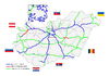 | |
|---|---|---|
| Expressways | ||
| Planned highways | ||
- ^ "National Toll Payment Services PLC". toll-charge.hu.
- Highways in Hungary