M60 motorway (Hungary)
This article may be expanded with text translated from the corresponding article in Hungarian. (January 2019) Click [show] for important translation instructions.
|
This article includes a list of references, related reading or external links, but its sources remain unclear because it lacks inline citations. (August 2018) |
 | |
|---|---|
| M60-as autópálya | |
 | |
| Route information | |
| Length | 30.2 km (18.8 mi) 56 km (35 mi) planned |
| Major junctions | |
| From | |
| To | Barcs |
| Location | |
| Counties | Baranya |
| Major cities | Pécs, Szigetvár |
| Highway system | |
| |
The M60 motorway (Hungarian: M60-as autópálya) is 56 km long. It begins at the Bóly interchange on the M6 and ends at Pécs. A future extension to the Croatian border at Barcs is planned. When finished, it will connect Pécs with Zagreb.
Municipalities[]
The M60 motorway runs through the following municipalities:
 Baranya County: Babarc, Szajk, Versend, Monyoród, Szederkény, Belvárdgyula, Birján, Lothárd, Szemely, Kozármisleny, Pécsudvard, Pécs
Openings timeline[]
Junctions, exits and rest area[]
This article contains a bulleted list or table of intersections which should be presented in a properly formatted junction table. (November 2021) |
 The route is full length motorway. The maximum speed limit is 130km/h.
| M60 (BÓLY - BARCS) | |||
| Exit | km | Destinations | Notes |
|---|---|---|---|
| 0 | Dunaújváros, Budapest / Ivándárda |
The road turns toward Budapest or the border | |
| 3 | Szajk rest area | ||
| 6 | |||
| Belvárdgyulai völgyhíd - 440 m | |||
| 15 | Birján rest area (plan) | ||
| 25 | Újpetre / Pécs-East | ||
| 30 | |||
| 32 | Pécs-Kökény Street | ||
See also[]
External links[]
| Wikimedia Commons has media related to Autópálya M60. |
- National Toll Payment Services Plc. (in Hungarian, some information also in English)
- National Infrastructure Developer Ltd. (in Hungarian)
- Exit list of M60 in motorways-exitlists.com
| Motorways | 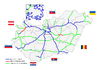 | |
|---|---|---|
| Expressways | ||
| Planned highways | ||
This Hungarian road or road transport-related article is a stub. You can help Wikipedia by . |
This European road or road transport-related article is a stub. You can help Wikipedia by . |
Categories:
- Highways in Hungary
- Hungary geography stubs
- Europe road stubs
- Hungary transport stubs