Maharagama
Maharagama | |
|---|---|
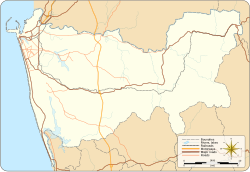 Maharagama Location of Maharagama in Colombo District | |
| Coordinates: 6°50′58″N 79°55′25″E / 6.84944°N 79.92361°ECoordinates: 6°50′58″N 79°55′25″E / 6.84944°N 79.92361°E | |
| Country | Sri Lanka |
| Province | Western Province |
| District | Colombo District |
| Government | |
| • Type | Urban Council |
| Population (2012) | |
| • Total | 195,355 |
| Time zone | UTC+5:30 (SLT) |
| Postal Code | 10280 [1] |

Maharagama is an outer suburb of Colombo, Sri Lanka on the High-Level (A4) Road about 10 km (6.2 mi) from the centre of the commercial capital. It developed rapidly in the 1980s as a dormitory suburb. Governed by the Maharagama Urban Council, the town possesses facilities like supermarkets, department stores, clothing, food and beverages shops to fulfill the needs of citizens.
There are number of bus routes passing the area and starting from the suburb that connect Maharagama to all the suburbs. The Sri Lanka Transport Board has a depot in Maharagama.
Maharagama Urban Council[]
Zone[]
- Mirihana
- Madivela
- Thalawathugoda
- Kottawa
- Pannipitiya
- Maharagama
- Godigamuwa[2]
Demographics[]
According to the census of 2012, the demographics of Maharagama by religion and ethnicity is as follows.
| 2012 | Percentage | |
|---|---|---|
| Buddhist | 179,649 | 91.96% |
| Roman Catholic | 6,582 | 3.37% |
| Other Christian | 3,267 | 1.67% |
| Hindu | 2,905 | 1.49% |
| Islam | 2,765 | 1.42% |
| Other | 187 | 0.10% |
| Total | 195,355 | 100.00% |
| Sinhalese | 187,363 | 95.90 |
| Sri Lankan Tamils | 3,107 | 1.59 |
| Sri Lankan Moors | 1,369 | 0.70 |
| Burghers | 1,343 | 0.68 |
| Sri Lankan Malays | 1,143 | 0.58 |
| Indian Tamils | 529 | 0.27 |
| Bharatha | 471 | 0.24 |
| Sri Lankan Chetty | 82 | 0.04 |
| Other | 16 | 0.00 |
| Total | 195,355 | 100.00% |
Important places around Maharagama[]
- (Bhikkhu Training Center)
- University of Sri Jayewardenepura
- Arpico Super Center, Navinna
- , Maharagama
Schools in Maharagama[]
Public transport[]
Railway[]
Trains starting from Colombo Fort stop at and nearby . The stations lie on the Kelani Valley Line, with local trains to Colombo Fort, Maradana, and .
Maharagama Railway Station is in the Pamunuwa area.
Currently the Kelani Valley Line serves an increasingly urbanizing population between Colombo Fort and Maharagama. Though capacity increased through broad-gauging the line, services face limitations due to sharp curves and the illegal construction on the sides of the track between Colombo and Maharagama.
Bus routes[]
Maharagama, which is in the middle of few important areas, has bus routes that access to the suburb centre.
Bus routes heading via Maharagama to/from Colombo: (via High Level Rd, Nugegoda and Kirulapona)
- 138 - Kottawa / Homagama
- 138/2 - Mattegoda
- 138/3 -
- 138/4 - Athurugiriya
- 122 - Avissawella / Ratnapura
- 125 - Padukka / Ingiriya
Local bus routes terminating at Maharagama:
- 138 - Colombo (Pettah)
- 112 - Kotahena
- 119 - Dehiwala (via Boralesgamuwa and )
- 119 - Nugegoda
- 993 - Malabe
- 122/1 - Avissawella (by Sri Lanka Transport Board - SLTB)
- 123 - Athurugiriya
- 124 -
- 128/1 - Moonamalewaththa
- 125/1 - Ingiriya/Padukka
- 129 - (by SLTB)
- 192 - Moratuwa
- 280 - Horana
- 341 - Piliyandala
- 341/1 -
- 341/2 -
- 345 - (via Government Cancer Institute)
- 990 - Vidyala Junction (via Dambahena / Weera Mawatha)
- 990/1 - Dambahena
- 212 - Hospital (Nawarohala)
- 991 - Hospital (Nawarohala)
- 994 - Hokandara (via Polwatta)
- 996 - Katukurunda
- 212/341 - (via Makuludoowa, Arawwala & Moraketiya)
Long-distance bus service via Maharagama to/from Colombo:
- 99 - Badulla / Welimada / Passara
- 122 - Ratnapura / Embilipitiya / Suriyawewa
- 57/16 - Anuradhapura
- 48/16 - Polonnaruwa
- 02/16/15 - Mannar
- 02/16/57 - Jaffna
- 16/48 - Batticalo
Long-distance bus service terminating at Maharagama operated by the SLTB:
- 02 - Galle / Matara (Normal Service)
- EX 001 - Galle / Matara (Luxury Service via the Southern Expressway)
- 69/122 - Kandy
- 16/122 - Kandy
- 17/57 - Anuradhapura
- 16/79 -
- 16/15 -
- 99 -
References[]
- ^ "Archived copy". Archived from the original on 12 October 2015. Retrieved 1 February 2016.CS1 maint: archived copy as title (link)
- ^ "Ward Maps of Colombo District – Maharagama Urban Council" (PDF).
- ^ "Department of Census and Statistics Sri Lanka - Population by ethnicity and district according to Divisional Secretary's Division, 2012".
- ^ "Department of Census and Statistics Sri Lanka - Population by divisional secretariat division, religion and sex- 2012" (PDF).
External links[]
- http://www.nysc.lk/ National Youth Services Council
- https://web.archive.org/web/20120109212828/http://www.ncisl.lk/ National Cancer Institute
- https://web.archive.org/web/20111112135050/http://www.vajiragnana.lk/sasana_sin.html Siri Vajiragnana Dharmayathanaya
- Google Map of Maharagama
- Suburbs of Colombo
- Populated places in Colombo District