Malay Peninsula
 Photo of Malay Peninsula taken by the crew of Expedition 28 on board the International Space Station. | |
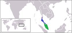 Location of the Malay Peninsula. | |
| Geography | |
| Location | Southeast Asia |
| Coordinates | 7°00′N 100°00′E / 7.000°N 100.000°ECoordinates: 7°00′N 100°00′E / 7.000°N 100.000°E |
| Adjacent bodies of water | Indian Ocean, Pacific Ocean |
| Area | 242,363.8 km2 (93,577.2 sq mi) |
| Highest elevation | 2,187 m (7175 ft) |
| Highest point | Mount Tahan |
| Administration | |
| Peninsular Malaysia | |
| Largest settlement | Kuala Lumpur |
| Region | Tanintharyi |
| District | Kawthaung |
| Largest settlement | Kawthaung |
| Southern Thailand | |
| Largest settlement | Hat Yai |

The Malay Peninsula (Malay: Semenanjung Tanah Melayu) is a peninsula in Mainland Southeast Asia. The landmass runs approximately north–south and, at its terminus, is the southernmost point of the Asian continental mainland. The area contains Peninsular Malaysia, Southern Thailand, and the southernmost tip of Myanmar (Kawthaung). The island country of Singapore also has historical and cultural ties with the region. The peninsula is indigenous to or historically inhabited by the Malays, an Austronesian people.
The Titiwangsa Mountains are part of the Tenasserim Hills system, and form the backbone of the peninsula. They form the southernmost section of the central cordillera which runs from Tibet through the Kra Isthmus (the peninsula's narrowest point) into the Malay Peninsula.[1] The Strait of Malacca separates the Malay Peninsula from the Indonesian island of Sumatra while the south coast is separated from the island of Singapore by the Straits of Johor.
Etymology[]
The Malay term Tanah Melayu is derived from the word Tanah (land) and Melayu (Malays), thus it means "the Malay land". The term can be found in various Malay texts, of which the oldest dating back to the early 17th century.[2] It is frequently mentioned in the Hikayat Hang Tuah, a well-known classic tale associated with the legendary heroes of Malacca Sultanate. Tanah Melayu in the text is consistently employed to refer to the area under Malaccan dominance.[3]
In the early 16th century, Tomé Pires, a Portuguese apothecary who stayed in Malaca from 1512 to 1515, uses an almost identical term, Terra de Tana Malaio, with which he referred to the southeastern part of Sumatra, where the deposed Sultan of Malacca, Mahmud Shah, established his exiled government. The 17th century's account of Portuguese historian, Emanuel Godinho de Erédia, noted on the region of Malaios surrounded by the Andaman Sea in the north, the entire Strait of Malacca in the centre, a part of Sunda Strait in the south, and the western part of South China Sea in the east.[4]
Prior to the foundation of Malacca, ancient and medieval references to a Malay peninsula exist in various foreign sources. According to several Indian scholars, the word Malayadvipa ("mountain-insular continent"), mentioned in the ancient Indian text, Vayu Purana, may possibly refer to the Malay Peninsula.[5][6][7] Another Indian source, an inscription on the south wall of the Brihadeeswarar Temple, recorded the word Malaiur, referring to a kingdom in the Malay Peninsula that had "a strong mountain for its rampart".[8][9] Ptolemy's Geographia named a geographical region of the Golden Chersonese as Maleu-kolon, a term thought to derive from Sanskrit malayakolam or malaikurram.[10] While the Chinese chronicle of the Yuan dynasty mentioned the word Ma-li-yu-er, referring to a nation of the Malay Peninsula that was threatened by the southward expansion of the Sukhothai Kingdom under King Ram Khamhaeng.[11][12] During the same era, Marco Polo made a reference to Malauir in his travelogue, as a kingdom located in the Malay Peninsula, possibly similar to the one mentioned in the Yuan chronicle.[13][14] The Malay Peninsula was conflated with Persia in old Japan, and was known by the same name.[15]
In the early 20th century, the term Tanah Melayu was generally used by the Malays of the peninsula during the rise of Malay nationalism to describe uniting all Malay states on the peninsula under one Malay nation, and this ambition was largely realised with the formation of Persekutuan Tanah Melayu (Malay for "Federation of Malaya") in 1948.[16]
Ecology[]
The Malay Peninsula is covered with tropical moist forests. Lowland forests are dominated by dipterocarp trees, while montane forests are home to evergreen trees in the beech family (Fagaceae), Myrtle family (Myrtaceae), laurel family (Lauraceae), tropical conifers, and other plant families.
The peninsula's forests are home to thousands of species of animals and plants. Several large endangered mammals inhabit the peninsula – Asian elephant (Elephas maximus), gaur (Bos gaurus), tiger (Panthera tigris), sun bear (Helarctos malayanus), Malayan tapir (Tapirus indicus), clouded leopard (Neofelis nebulosa), and siamang (Symphalangus syndactylus).[17] The Sumatran rhinoceros (Dicerorhinus sumatrensis) once inhabited the forests, but Malaysia's last rhinoceroses died in 2019, and the species' few remaining members survive only in Sumatra.[18]
The peninsula is home to several distinct ecoregions. The Tenasserim-South Thailand semi-evergreen rain forests cover the northern peninsula, including the Tenasserim Hills and the Isthmus of Kra, and extend to the coast on both sides of the isthmus.
The Kangar-Pattani floristic boundary crosses the peninsula in southern Thailand and northernmost Malaysia, marking the boundary between the large biogeographic regions of Indochina to the north and Sundaland and Malesia to the south. The forests north of the boundary are characterized by seasonally-deciduous trees, while the Sundaland forests have more year-round rainfall and the trees are mostly evergreen. Peninsular Malaysia is home to three terrestrial ecoregions. The Peninsular Malaysian montane rain forests ecoregion covers the mountains above 1000 meters elevation. The lowlands and hills are in the Peninsular Malaysian rain forests ecoregion. The Peninsular Malaysian peat swamp forests include distinctive waterlogged forests in the lowlands on both sides of the peninsula.[19]
Extensive mangroves line both coasts. The Myanmar Coast mangroves are on the western shore of the peninsula, and the Indochina mangroves on the eastern shore.
See also[]
- Malay Archipelago
- Malaya (disambiguation)
- Tenasserim Hills
- Malaysia–Thailand border
References[]
- ^ The Physical Geography of Southeast Asia, Avijit Gupta
- ^ Mohamed An war Omar Din (2012). "Legitimacy of the Malays as the Sons of the Soil". Asian Social Science. Canadian Center of Science and Education: 80–81. ISSN 1911-2025.
- ^ Reid, Anthony (2010). Imperial alchemy : nationalism and political identity in Southeast Asia. Cambridge University Press. p. 95. ISBN 978-0-521-87237-9.
- ^ Mohamed Anwar Omar Din (2011). "Asal Usul Orang Melayu: Menulis Semula Sejarahnya (The Malay Origin: Rewrite Its History)". Jurnal Melayu, Universiti Kebangsaan Malaysia. pp. 28–30. Retrieved 4 June 2012.
- ^ Pande, Govind Chandra (2005). India's Interaction with Southeast Asia: History of Science,Philosophy and Culture in Indian Civilization, Vol. 1, Part 3. Munshiram Manoharlal. p. 266. ISBN 978-81-87586-24-1.
- ^ Mukerjee, Radhakamal (1984). The culture and art of India. Coronet Books Inc. p. 212. ISBN 978-81-215-0114-9.
- ^ Sarkar, Himansu Bhusan (1970). Some contributions of India to the ancient civilisation of Indonesia and Malaysia. Calcutta: Punthi Pustak. p. 8. ASIN B000PFNF5C.
- ^ Langer, William Leonard (1973). An Encyclopedia of World History: Ancient, Medieval, and Modern, Chronologically Arranged. Houghton Mifflin Co. p. 362. ISBN 978-0-395-13592-1.
- ^ Kotha, Satchidananda Murthy; S., Sankaranarayanan (2002). Life, thought, and culture in India, c. AD 300-1000. Centre for Studies in Civilizations. p. 121. ISBN 978-81-87586-09-8.
- ^ Gerini, Gerolamo Emilio (1974). Researches on Ptolemy's geography of eastern Asia (further India and Indo-Malay archipelago). Oriental Books Reprint Corporation. p. 101. ISBN 81-7069-036-6.
- ^ Guoxue (2003). "Chronicle of Mongol Yuan".
- ^ Hall, Daniel George Edward (1981). History of South East Asia. Macmillan. p. 190. ISBN 978-0-333-24163-9.
- ^ Cordier, Henri (2009). Ser Marco Polo; notes and addenda to Sir Henry Yule's edition, containing the results of recent research and discovery. Bibliolife. p. 105. ISBN 978-1-110-77685-6.
- ^ Wright, Thomas (2004). The travels of Marco Polo, the Venetian: the translation of Marsden revised, with a selection of his notes. Kessinger Publishing, LLC. pp. 364–365. ISBN 978-1-4191-8573-1.
- ^ Ziro Uraki, Utsuho Monogatari footnotes, p. 2
- ^ Bunnell, Tim (2004). "From nation to networks and back again: Transnationalism, class and national identity in Malaysia". State/Nation/Transnation: Perspectives on Transnationalism in the Asia Pacific. Routledge: 1984. ISBN 0-415-30279-X.
- ^ Wikramanayake, Eric; Eric Dinerstein; Colby J. Loucks; et al. (2002). Terrestrial Ecoregions of the Indo-Pacific: a Conservation Assessment. Washington, DC: Island Press.
- ^ Williams, David; Ko, Stella (24 November 2019). "The last Sumatran rhino in Malaysia has died and there are less than 80 left in the world". CNN. Retrieved 27 November 2019.
- ^ Wikramanayake, Eric; Eric Dinerstein; Colby J. Loucks; et al. (2002). Terrestrial Ecoregions of the Indo-Pacific: a Conservation Assessment. Washington, DC: Island Press.
External links[]
![]() Media related to Malay Peninsula at Wikimedia Commons
Media related to Malay Peninsula at Wikimedia Commons
- . . 1914.
| hide Authority control | |
|---|---|
| General | |
| Other | |
- Malay Peninsula
- Andaman Sea
- Flora of Malaya
- Gulf of Thailand
- Landforms of Malaysia
- Landforms of Myanmar
- Landforms of the South China Sea
- Landforms of Thailand
- Malaya
- Malesia
- Peninsulas of Asia
- Regions of Asia
- Southern Thailand
- Strait of Malacca