Manbhum
This article needs additional citations for verification. (July 2013) |
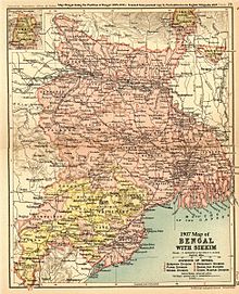
1907 Map of Bengal with Sikkim
Manbhum District was one of the districts of the East India during the British Raj.[1] After India's independence, the district became a part of Bihar State. Upon re-organisation of the Indian states in the mid-1950s, present Purulia district was carved out of the district of Manbhum and became a part of the West Bengal; the remaining part of Manbhum district was kept with Bihar state and became part of Dhanbad district.[2]
See also[]
References[]
- ^ Chisholm, Hugh, ed. (1911). . Encyclopædia Britannica. Vol. 17 (11th ed.). Cambridge University Press. p. 542.
- ^ Anil (2014-11-05). "History of Manbhum". Anil mandal's blog. Retrieved 2020-01-07.
Further reading[]
- Coupland, H. Bengal District Gazetteers Manbhum. The Bengal Secretariat Book Depot Calcutta. Retrieved 24 December 2016.
Capital: Patna | |
| State symbols | |
| History |
|
| Administration |
|
| Overviews | |
| Divisions and districts |
|
| Cities | |
| Municipal Corporation |
|
| Politics | |
| Culture |
|
Capital: Kolkata | |||||||||||
| State symbols |
| ||||||||||
| History |
| ||||||||||
| Geography |
| ||||||||||
| Governance |
| ||||||||||
| Rights groups | |||||||||||
| Division and Districts |
| ||||||||||
| Cities and towns |
| ||||||||||
| Culture |
| ||||||||||
| GI product | |||||||||||
| Demographics |
| ||||||||||
| People |
| ||||||||||
Coordinates: 23°20′N 86°22′E / 23.333°N 86.367°E

This Indian location article is a stub. You can help Wikipedia by . |
Categories:
- History of Bengal
- History of West Bengal
- Former districts of Bihar
- India geography stubs