Maple Mountains
| Javorníky | |
|---|---|
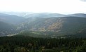
 Veľký Javorník | |
| Highest point | |
| Peak | Veľký Javorník |
| Elevation | 1,071 m (3,514 ft) |
| Coordinates | 49°31′35″N 18°9′45″E / 49.52639°N 18.16250°ECoordinates: 49°31′35″N 18°9′45″E / 49.52639°N 18.16250°E |
| Geography | |
 Javorníky within the geomorphological division of Slovakia and the Czech Republic
| |
| Countries | Slovakia and Czech Republic |
| Parent range | Western Carpathians |

The Maple Mountains,[1][2] Javornik Mountains,[3][4] or Javorniks[5] (Czech and Slovak: Javorníky) are a mountain range of the Slovak-Moravian Carpathians that forms part of the border between the Czech Republic and Slovakia.
Its highest point is at 1,071 meters (3,514 ft). The range stretches from the White Carpathians in the south to the Beskids in the north. The range divides the Bečva and Oder river systems from those of the Turiec and Váh along the European Watershed. Part of the range falls within the Slovak Kysuce Protected Landscape Area.
References[]
- ^ Poldauf, Ivan (1997). Comprehensive Czech–English Dictionary (3 ed.). Čelákovice: WD Publications. p. 1145.
- ^ Borden, Carla M. (1995). 1995 Festival of American Folklife. Washington, DC: Smithsonian. p. 46.
- ^ Šandorfi, Rudolf (1996). History of Slovakia. Toronto: Zahraničná Matica slovenská. p. 208.
- ^ Library of Congress Subject Headings, Volume 4. Washington, DC: Library of Congress. 2013. p. 488.
- ^ Widawski, Krzysztof; Wyrzykowski, Jerzy (2017). The Geography of Tourism of Central and Eastern European Countries. Cham: Springer. p. 442.
| show Authority control |
|---|
This Czech location article is a stub. You can help Wikipedia by . |
Categories:
- Mountain ranges of the Western Carpathians
- Mountain ranges of Slovakia
- Mountain ranges of the Czech Republic
- Czech Republic geography stubs
- Slovakia geography stubs