Massangena District
Massangena | |
|---|---|
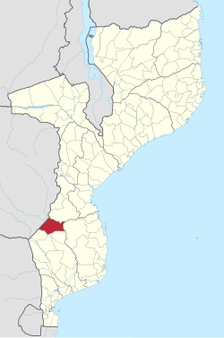 Massangena District on the map of Mozambique | |
| Country | Mozambique |
| Province | Gaza |
| Capital | Massangena |
| Area | |
| • Total | 7,481 km2 (2,888 sq mi) |
| Population (2007 census) | |
| • Total | 15,637 |
| • Density | 2.1/km2 (5.4/sq mi) |
Massangena District is a district of Gaza Province in south-western Mozambique. The administrative center of the district is Massangena. The district is located in the north of the province, and borders with Machaze District of Manica Province in the north, Mabote District of Inhambane Province in the east, Chigubo District in the southeast, Chicualacuala District in the south, and with Chiredzi District of Zimbabwe in the west. The area of the district is 7,481 square kilometres (2,888 sq mi).[1] It has a population of 15,637 (2007).[2]
Geography[]
The area of the district is shared between drainage basins of the Changane River, a major left tributary of the Limpopo River, and the Save River.[1]
The climate is tropical semi-arid, with the average annual rainfall varying between 500 millimetres (20 in) and 800 millimetres (31 in).[1]
Demographics[]
As of 2005, 41% of the population of the district was younger than 15 years. 16% of the population spoke Portuguese. The most common mothertongue among the population was Tsonga. 78% were analphabetic, mostly women.[1]
Administrative divisions[]
The district is divided into two postos, Massangena (six localities) and (four localities).[1]
Economy[]
Less than 1% of the households in the district have access to electricity.[1]
Agriculture[]
In the district, there are 2,500 farms which have on average 2.7 hectares (0.010 sq mi) of land. The main agricultural products are corn, cassava, cowpea, peanut, sweet potato, and rice.[1]
Transportation[]
There is a road network in the district which includes about 603 kilometres (375 mi) of secondary roads, mainly connecting Massngena with the rest of the district as well as with and Chicualacuala.[1]
References[]
- ^ Jump up to: a b c d e f g h "Perfil do Distrito de Massangena" (PDF) (in Portuguese). Ministry of State Administration. 2005. Retrieved 26 October 2016.
- ^ "População da Provincia de Gaza". Censo 2007 (in Portuguese). Instituto Nacional de Estatística. Archived from the original on 2008-02-22. Retrieved 2008-03-18.
Coordinates: 21°32′16″S 32°57′23″E / 21.53778°S 32.95639°E

| Authority control |
|
|---|
- Districts in Gaza Province