Limpopo River
| Limpopo River Vhembe | |
|---|---|
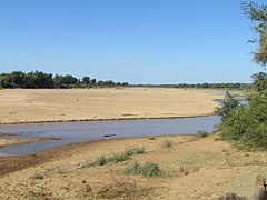
 Limpopo River in Mozambique | |
 Course and watershed of the Limpopo River | |
| Location | |
| Country | South Africa, Botswana, Zimbabwe, Mozambique |
| Physical characteristics | |
| Source confluence | Marico and Crocodile |
| • location | Botswana/South Africa border |
| • elevation | 872 m (2,861 ft) |
| Mouth | Indian Ocean |
• location | Gaza Province, Mozambique |
| Length | 1,750 km (1,090 mi) |
| Basin size | 415,000 km2 (160,000 sq mi) |
| Discharge | |
| • average | 170 m3/s (6,000 cu ft/s) |
The Limpopo River rises in South Africa,[1] and flows generally eastwards through Mozambique to the Indian Ocean. The term Limpopo is derived from Rivombo (Livombo/Lebombo), a group of Tsonga settlers led by Hosi Rivombo who settled in the mountainous vicinity and named the area after their leader. The river is approximately 1,750 kilometres (1,087 mi) long, with a drainage basin 415,000 square kilometres (160,200 sq mi) in size. The mean discharge measured over a year is 170 m3 (6,000 cu ft; 170,000 l; 44,900 US gal) at its mouth.[2] The Limpopo is the second largest river in Africa that drains to the Indian Ocean, after the Zambezi River.[citation needed]
The first European to sight the river was Vasco da Gama, who anchored off its mouth in 1498 and named it Espirito Santo River. Its lower course was explored by St Vincent Whitshed Erskine in 1868–69, and Captain J F Elton travelled down its middle course in 1870.
The drainage area of Limpopo River has decreased over geological time. Up to Late Pliocene or Pleistocene times, the upper course of the Zambezi River drained into the Limpopo River.[3] The change of the drainage divide is the result of epeirogenic movement that uplifted the surface north of present-day Limpopo River, diverting waters into Zambezi River.[4]
Course[]

The river flows in a great arc, first zigzagging north and then north-east, then turning east and finally south-east. It serves as a border for about 640 kilometres (398 mi), separating South Africa to the southeast from Botswana to the northwest and Zimbabwe to the north. Two of its tributaries, the Marico River and the Crocodile River join, at which point the name changes to Limpopo River. There are several rapids as the river falls off Southern Africa's inland escarpment.
The Notwane River is a major tributary of the Limpopo, rising on the edge of the Kalahari Desert in Botswana and flowing in a north-easterly direction.[5] The main tributary of the Limpopo, the Olifants River (Elephant River), contributes around 1,233 million m3 of water per year.[6] Other major tributaries include the Shashe River, Mzingwane River, Crocodile River, Mwenezi River and Luvuvhu River.[7]
In the north-eastern corner of South Africa the river borders the Kruger National Park.
The port town of Xai-Xai, Mozambique is on the river near the mouth. Below the Olifants, the river is permanently navigable to the sea, though a sandbar prevents access by large ships except at high tide.
Tributaries[]
Left hand[]
- Notwane River
- Bonwapitse River
- Mahalapswe River
- Lotsane River
- Motloutse River
- Shashe River
- Umzingwani River
- Bubi River
- Mwenezi River
- Changane River
Right hand[]
- Marico River
- Crocodile River
- Matlabas River
- Mokolo River
- Palala River
- Mogalakwena River
- Kolope River
- Sand River
- Nwanedi River
- Luvuvhu River
- Olifants River
Basin characteristics[]

The waters of the Limpopo flow sluggishly, with considerable silt content. Rudyard Kipling's characterization of the river as the "great grey-green, greasy Limpopo River, all set about with fever-trees," where the "Bi-Coloured Python Rock-Snake" dwells[8] in the Just So Stories is apt. Rainfall is seasonal and unreliable: in dry years, the upper parts of the river flow for 40 days or less. The upper part of the drainage basin, in the Kalahari Desert, is arid but conditions become less arid further downriver. The next reaches drain the Waterberg Massif, a biome of semi-deciduous forest and low-density human population.[9] The fertile lowlands support a denser population, and about 14 million people live in the Limpopo basin. Flooding during the rainy season is an occasional problem in the lower reaches. During February 2000 heavy rainfalls due to a cyclone caused the catastrophic 2000 Mozambique flood.
The highest concentration of hippopotamus in the Limpopo River is found between the Mokolo and the Mogalakwena Rivers.[10]
There is a lot of mining activity in the Limpopo River basin with about 1,900 functioning mines, not counting about 1,700 abandoned mines.[11]
History[]
Vasco da Gama, on his first expedition, was probably among the first Europeans to sight the river, when he anchored off the mouth in 1498. However, there has been human habitation in the region since time immemorial — sites in the Makapans Valley near Mokopane contain Australopithecus fossils from 3.5 million years ago. St Vincent Whitshed Erskine, later Surveyor General for South Africa, traveled to the mouth of the river in 1868-69.[12]
A Zambezi shark (Carcharhinus leucas) was caught hundreds of kilometres upriver at the confluence of the Limpopo and Luvuvhu Rivers in July 1950. Zambezi sharks tolerate fresh water and can travel far up the Limpopo.[13]
In 2013, approximately 15,000 Nile crocodiles were accidentally released into the river from flood gates at the nearby Rakwena Crocodile Farm.[14]
Gallery[]
The river as seen from Crook's Corner in Kruger National Park, South Africa. Straight ahead of the river is Mozambique. Across the river is Zimbabwe.

Crossing Limpopo in Mozambique


See also[]
- Great Limpopo Transfrontier Park
- List of international border rivers
- Drainage basin A
References[]
- ^ "Limpopo River", Encyclopædia Britannica, retrieved 2018-04-29
- ^ Nakayama, Mikiyasu (2003). International Waters in Southern Africa. United Nations University Press. p. 9. ISBN 92-808-1077-4.; online at Google Books
- ^ Goudie, A.S. (2005). "The drainage of Africa since the Cretaceous". Geomorphology. 67: 437–456.
- ^ Moore, A.E. (1999). "A reapprisal of epeirogenic flexure axes in southern Africa". South African Journal of Geology. 102 (4): 363–376.
- ^ The Notwane River, Botswana[permanent dead link]
- ^ Görgens, A.H.M. and Boroto, R.A. 1997. Limpopo River: flow balance anomalies, surprises and implications for integrated water resources management. In: Proceedings of the 8th South African National Hydrology Symposium, Pretoria, South Africa.
- ^ "Drought impact mitigation and prevention in the Limpopo River Basin". www.fao.org. Retrieved 5 April 2018.
- ^ The Elephant's Child, Rudyard Kipling
- ^ C.Michael Hogan, Mark L. Cooke and Helen Murray, The Waterberg Biosphere, Lumina Technologies, May 22, 2006. "Archived copy". Archived from the original on 2007-03-24. Retrieved 2006-12-23.CS1 maint: archived copy as title (link)
- ^ State of Rivers Report: the Mokolo River
- ^ "Mines in the Limpopo River basin". limpoporak.org. Archived from the original on 2016-03-04. Retrieved 5 April 2018.
- ^ Erskine, Vincent W. (1869). "Journey of Exploration to the Mouth of the River Limpopo". The Journal of the Royal Geographical Society of London. 39: 233–276. doi:10.2307/1798552. JSTOR 1798552.
- ^ Pienaar, U. de V., The Freshwater Fishes of the Kruger National Park, Koedoe Vol 11, No 1 (1968)
- ^ Editorial, Reuters. "South Africa police join hunt for 10,000 escaped crocodiles". reuters.com. Archived from the original on 17 November 2015. Retrieved 5 April 2018.
External links[]
| Wikimedia Commons has media related to Limpopo River. |
- Climate change implications for water resources in the Limpopo River Basin, study by IFPRI
- Green and blue water accounting in the Limpopo and Nile Basins, study by IFPRI
- Limpopo Watercourse Commission (LIMCOM) www.limcom.org
- Limpopo River Awareness Kit
- FROC - Reference frequency of occurrence of fish species in South Africa
Coordinates: 25°10′S 33°35′E / 25.167°S 33.583°E

| Authority control |
|---|
- Rivers of South Africa
- Rivers of Zimbabwe
- Rivers of Mozambique
- Limpopo River
- Rivers of Botswana
- International rivers of Africa
- Mozambique Channel
- Border rivers
- Botswana–South Africa border
- South Africa–Zimbabwe border
- Rivers of North West (South African province)