Maysville, Arkansas
Maysville, Arkansas | |
|---|---|
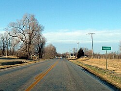 Maysville southern limits, February 2013 | |
 Location of Maysville in Benton County, Arkansas. | |
 Maysville, Arkansas Location of Maysville in Benton County, Arkansas. | |
| Coordinates: 36°24′13″N 94°36′07″W / 36.40361°N 94.60194°W | |
| Country | United States |
| State | Arkansas |
| County | Benton |
| Area | |
| • Total | 2.35 sq mi (6.10 km2) |
| • Land | 2.35 sq mi (6.10 km2) |
| • Water | 0.00 sq mi (0.00 km2) |
| Elevation | 1,043 ft (318 m) |
| Population (2020) | |
| • Total | 117 |
| • Density | 49.70/sq mi (19.19/km2) |
| Time zone | UTC-6 (Central (CST)) |
| • Summer (DST) | UTC-5 (CDT) |
| Area code(s) | 479 |
| GNIS feature ID | 77622[2] |

Maysville is an unincorporated community in Benton County, Arkansas, United States. It is the westernmost settlement in the state of Arkansas.[3] As of the 2010 census, its population is 130.[4]
History[]
A post office has been in operation at Maysville since 1850.[5] Maysville once rivaled Bentonville in size, according to local history.[6]
Maysville is the location of (or is the nearest community to) Coats School, which is located on Spavinaw Creek Rd. and Sellers Farm, which is located on Old Hwy. on State Line. Both are listed on the National Register of Historic Places.[7]
Demographics[]
| Historical population | |||
|---|---|---|---|
| Census | Pop. | %± | |
| 2020 | 117 | — | |
| U.S. Decennial Census[8] | |||
References[]
- ^ "2020 U.S. Gazetteer Files". United States Census Bureau. Retrieved October 29, 2021.
- ^ U.S. Geological Survey Geographic Names Information System: Maysville, Arkansas
- ^ "EXTREME SETTLEMENTS: A COMPREHENSIVE LIST". Weekend Roady. 2013-05-02. Retrieved 2014-08-20.
- ^ "U.S. Census website". U.S. Census Bureau. Retrieved 6 May 2011.
- ^ "Post Offices". Jim Forte Postal History. Retrieved 1 February 2018.
- ^ History of Benton, Washington, Carroll, Madison, Crawford, Franklin, and Sebastian Counties, Arkansas. Higginson Book Company. 1889. p. 111.
- ^ "National Register Information System". National Register of Historic Places. National Park Service. March 13, 2009.
- ^ "Census of Population and Housing". Census.gov. Retrieved June 4, 2016.
Municipalities and communities of Benton County, Arkansas, United States | ||
|---|---|---|
| Cities |  | |
| Towns | ||
| Townships | ||
| CDPs | ||
| Other communities | ||
| Ghost towns | ||
| Footnotes | ‡This populated place also has portions in an adjacent county or counties | |
| ||
Coordinates: 36°24′13″N 94°36′07″W / 36.40361°N 94.60194°W
Categories:
- Census-designated places in Benton County, Arkansas
- Census-designated places in Arkansas
- 1850 establishments in Arkansas
- Northwest Arkansas geography stubs